Near Wamsutter in Carbon County, Wyoming — The American West (Mountains)
Overland Trail
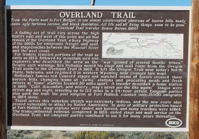
A fading set of trail ruts across the high desert east and west of this point are all that remains of the Overland Trail, a busy highway of the 1860s for emigrants, freight and mail, and stagecoaches between the Missouri River and the west coast.
Fur traders traveled portions of the trail as early as 1825, followed by mountain men and explorers, who described the area as the "war ground of several hostile tribes." Despite such warnings, Ben Holladay moved his stage and mail route from the Oregon Trail south to the Overland Trail in 1862. It left the Oregon Trail near today's North Platte, Nebraska, and rejoined it in western Wyoming near Granger (see map). Holiday's famous red Concord stages and matched teams of horses crossed these barren hills, changing teams at "swing" stations and procuring meals and fresh drivers at "home" stations located 50 miles apart. A traveler described a home station in 1866: "Cold, discomfort, and misery ... may I never see the like again!" Stages were driven day and night, traveling up to 125 miles in a 24-hour period. Emigrant parties also used the trail: the post surgeon at Fort Halleck counted 17,000 emigrants in 1862 alone.
Travel across this waterless stretch was extremely tedious, and the new route also proved vulnerable to attack by Native Americans. In spite of military protection based at Fort Halleck, stage stations were raided and burned, and many travelers were killed. The transcontinental railroad, completed in 1869, ended stage and mail service on the Overland Trail, but emigrant parties continued to use it for many years thereafter.
Erected by Snyder Oil Corporation.
Topics and series. This historical marker is listed in this topic list: Roads & Vehicles. In addition, it is included in the Overland Trail series list.
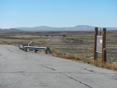
Location. 41° 27.468′ N, 107° 45.738′ W. Marker is near Wamsutter, Wyoming, in Carbon County. Marker is on State Highway 789 near Interstate 80, on the right when traveling south. Touch for map. Marker is in this post office area: Wamsutter WY 82336, United States of America. Touch for directions.
Other nearby markers. At least 1 other marker is within walking distance of this marker. The Overland Stage Station Route (a few steps from this marker).
More about this marker. This maker is on Wyoming Highway 789 about 9 miles south of Creston Junction
Credits. This page was last revised on June 16, 2016. It was originally submitted on October 19, 2015, by Barry Swackhamer of Brentwood, California. This page has been viewed 448 times since then and 15 times this year. Photos: 1, 2. submitted on October 19, 2015, by Barry Swackhamer of Brentwood, California.

