Grundy in Buchanan County, Virginia — The American South (Mid-Atlantic)
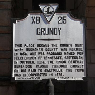
Grundy
Erected 1941 by Virginia Conservation Commission. (Marker Number XB-25.)
Topics and series. This historical marker is listed in these topic lists: Political Subdivisions • War, US Civil. In addition, it is included in the Virginia Department of Historic Resources (DHR) series list. A significant historical year for this entry is 1858.
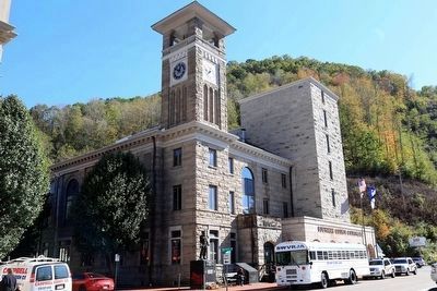
Location. 37° 16.668′ N, 82° 5.965′ W. Marker is in Grundy, Virginia, in Buchanan County. Marker is at the intersection of Main Street and Walnut Street (Local Route T-1003), on the left when traveling south on Main Street. It is in front of the courthouse. Touch for map. Marker is in this post office area: Grundy VA 24614, United States of America. Touch for directions.
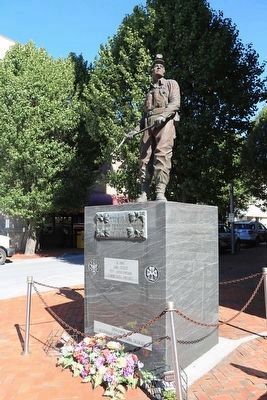
Other nearby markers. At least 8 other markers are within 11 miles of this marker, measured as the crow flies. Buchanan County Confederate Memorial (a few steps from this marker); Buchanan County War Memorial (a few steps from this marker); Buchanan County Vietnam War Memorial (a few steps from this marker); Buchanan County / Kentucky (approx. 8.8 miles away); Buchanan County / Dickenson County (approx. 8.8 miles away); The Crooked Road (approx. 10.4 miles away); Mill Rock Point Overlook (approx. 10.4 miles away); Mill Rock Point (approx. 10.4 miles away). Touch for a list and map of all markers in Grundy.
Also see . . . Wikipedia Entry. “Since 1929, Grundy has suffered nine major floods of the adjoining Levisa Fork River. After the inundation of April 4, 1977, many businesses did not reopen, and the buildings that housed them were abandoned. A project to relocate much of the town to higher ground has been completed. The project started in 2001 and consisted of blasting the mountain across the Levisa Fork to create 13 acres of land. After a few years of blasting, utilities were placed and new bridges across the river were built. A new downtown is planned where a multi-level Wal-Mart with a parking deck has just opened. Buildings backing on the river have been demolished and a new flood wall protects the county courthouse. U.S. Route 460 has been relocated to the top of the flood wall. Businesses formerly located downtown were relocated to an industrial building located just outside of town.rdquo; (Submitted on October 19, 2015.)
Credits. This page was last revised on June 16, 2016. It was originally submitted on October 19, 2015, by J. J. Prats of Powell, Ohio. This page has been viewed 651 times since then and 59 times this year. Photos: 1, 2, 3, 4, 5. submitted on October 19, 2015, by J. J. Prats of Powell, Ohio.


