
Near Sinclair in Carbon County, Wyoming — The American West (Mountains)
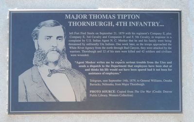
Major Thomas Tipton Thornburgh
Photographed by Barry Swackhamer, September 9, 2015
1. Major Thomas Tipton Thornburgh Marker
Caption: Photo Source: Copied from The Ute War
"Agent Meeker writes me he expects serious trouble from the Utes and sends a dispatch to the Department that employees have been shot at and thinks his life would not have been spared had it not been for assistance of employees." - Telegram, sent September 14th, 1879, to General Williams, Omaha Barracks, Nebraska, from Major Thornburgh.
Erected by Wyoming Recreation Commission.
Topics. This historical marker is listed in this topic list: Wars, US Indian. A significant historical date for this entry is September 21, 1879.
Location. 41° 46.669′ N, 106° 56.767′ W. Marker is near Sinclair, Wyoming,
this page online

Regionally, this marker is in Wyoming’s Westward Expansion Trails Region. It is also in the American Mountain West. Globally, it is in North America, the Rocky Mountains, the Western Hemisphere, the Western World, and the Anglosphere. Historically, it finds itself in what was once the Republic of Texas.
Other nearby markers. At least 8 other markers are within walking distance of this marker: Rock Springs Massacre (here, next to this marker); Thornburgh's Command (here, next to this marker); Image of Fort Fred Steele (here, next to this marker); Major General Frederick Steele (here, next to this marker); Major General Philippe Regis de Trobriand (here, next to this marker); Viewing the Fort Grounds (within shouting distance of this marker); Fort Fred Steele after 1886 (within shouting distance of this marker); Enlisted Men's Barracks (about 300 feet away, measured in a direct line). Touch for a list and map
Photographed by Barry Swackhamer, September 9, 2015
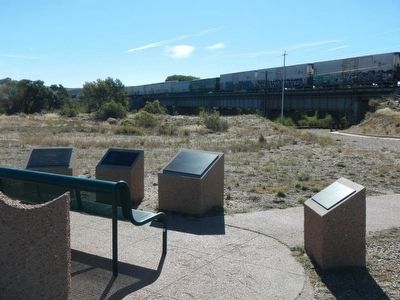
2. Major Thomas Tipton Thornburgh Marker
This marker is second from the left.
More about this marker. This marker, among a grouping of a half-dozen other markers, is located at Fort Fred Steele State Park on County Road 347, north of the Interstate 80 Exit 228 and on the north side of the railroad tracks near where County Road 347 passes beneath the railroad bridge.
Credits. This page was last revised on June 16, 2016. It was originally submitted on October 21, 2015, by Barry Swackhamer of Brentwood, California. This page has been viewed 793 times since then and 49 times this year. Photos: 1, 2. submitted on October 21, 2015, by Barry Swackhamer of Brentwood, California.
