Near Dickensonville in Russell County, Virginia — The American South (Mid-Atlantic)
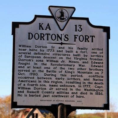
Dortonís Fort
Erected 2004 by Department of Historic Resources. (Marker Number KA-13.)
Topics and series. This historical marker is listed in these topic lists: Forts and Castles • Native Americans • Settlements & Settlers • War, US Revolutionary. In addition, it is included in the Virginia Department of Historic Resources (DHR), and the Virginia, Clinch River Forts Circa 1774 series lists. A significant historical year for this entry is 1773.
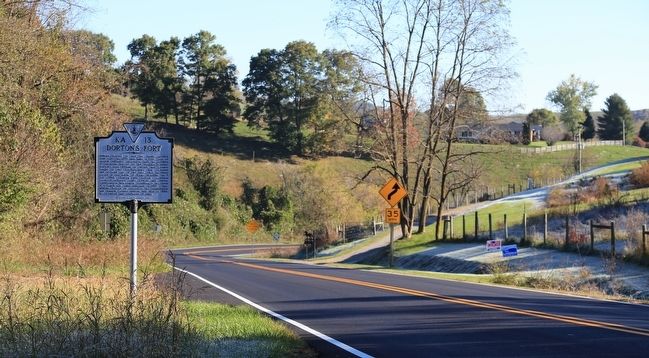
Location. 36° 48.581′ N, 82° 16.846′ W. Marker is near Dickensonville, Virginia, in Russell County. Marker is at the intersection of Virginia Route 71 and Lakeview Circle (County Route 785), on the right when traveling south on State Route 71. Touch for map. Marker is in this post office area: Castlewood VA 24224, United States of America. Touch for directions.
Other nearby markers. At least 8 other markers are within 10 miles of this marker, measured as the crow flies. Old Russell County Courthouse (approx. 2.9 miles away); Early Settlers in Russell County (approx. 3.8 miles away); Mooreís Fort (approx. 4.6 miles away); Russellís Fort (approx. 4.7 miles away); Veterans Memorial (approx. 6.8 miles away); Houstonís Fort (approx. 8.4 miles away); Jesseeís Mill (approx. 8.6 miles away); Russell County / Washington County (approx. 9.2 miles away). Touch for a list and map of all markers in Dickensonville.
Also see . . . Frontier Forts of Southwestern Virginia. 1968 historical sketch by Emory L. Hamilton. Entry for Dorton's Fort: “Located about one mile southeast of Nickelsville on the Combs Farm, this was the home of old William Dorton, Sr., who was killed by the Indians in July, 1780. (45) Undoubtedly this was just another family fort-house, and there is no record of it ever having a complement of militia. When it was built is unknown, but likely sometime in the 1770's. The family of William Dorton continued to live at the place after he was slain. The court records of the 1780's refer to it as "Dortonís Old Fort", meaning that it may have fallen into disuse and disrepair.
“Little is known of the life of William Dorton, Sr., prior to his untimely death at the hands of the Indians, even the place and details of his death are unknown. His son, William Dorton, Jr., was in one of the parties that pursued the Indians under Benge after his capture of the Livingston family in 1794. This party led by Captain William Dorton, Jr., overtook one of the Indian parties, who seem to have split into three separate groups after the capture and killing, and killed one of the Indians in that particular group.” (Submitted on October 22, 2015.)
Credits. This page was last revised on June 16, 2016. It was originally submitted on October 22, 2015, by J. J. Prats of Powell, Ohio. This page has been viewed 1,734 times since then and 165 times this year. Photos: 1, 2. submitted on October 22, 2015, by J. J. Prats of Powell, Ohio.

