Near Snowflake in Scott County, Virginia — The American South (Mid-Atlantic)
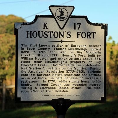
Houstonís Fort
Erected 2003 by Department of Historic Resources. (Marker Number K-17.)
Topics and series. This historical marker is listed in these topic lists: Forts and Castles • Settlements & Settlers • Wars, US Indian. In addition, it is included in the Virginia Department of Historic Resources (DHR), and the Virginia, Clinch River Forts Circa 1774 series lists. A significant historical year for this entry is 1774.
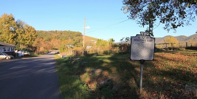
Location. 36° 42.85′ N, 82° 22.414′ W. Marker is near Snowflake, Virginia, in Scott County. Marker is on Big Moccasin Road (County Route 613) 6.7 miles east of Nickelsville Highway (Virginia Route 71), on the right when traveling west. Touch for map. Marker is in this post office area: Nickelsville VA 24271, United States of America. Touch for directions.
Other nearby markers. At least 8 other markers are within 10 miles of this marker, measured as the crow flies. Kilgore Fort House (approx. 3.7 miles away); At the Park (approx. 3.8 miles away); A. P. Carter Boyhood Home (approx. 3.8 miles away); A. P. Carter Grocery (approx. 3.8 miles away); Early Settlers in Russell County (approx. 5.1 miles away); June Carter Cash (approx. 6.7 miles away); Dortonís Fort (approx. 8.4 miles away); Patrick Hagan and Dungannon (approx. 9.4 miles away).
More about this marker. An earlier version of a marker at this location with the same title and number read, ďThe first settlement in what is now Scott County was established on this site by Thomas McCulloch in 1769. In 1771, the settlement was abandoned in fear of Indian attack. William Houston, assignee of Thomas McCulloch, constructed a fort here in 1774. During an attack on the fort by a large force of Charokee Indians in 1776, Samuel Cowan, a messenger, was killed and scalped.Ē
Also see . . . Frontier Forts of Southwest Virginia. 1968 article by Emory L. Hamilton in Historical Sketches of Southwest Virginia. Scroll down for the section about Houstonís Fort. Excerpt:
Samuel Cowan who lived in lower Castlewood had raced across country on a borrowed stud horse belonging to Deskin Tibbs to warn the station that Indians were in the area and arrived before any attack had been made upon the fort. After delivering his message he insisted upon returning to his home against the advice of those in the fort and started upon his return and was fired upon a short distance from the fort. The defenders of the fort hearing the shots sallied out to his assistance, found him shot and scalped, but still alive. He was carried into the fort, but died a short time afterwards. The horse Cowan was riding was uninjured and reached Castlewood, covered with sweat and lather from the long run, and Mrs. Cowan seeing the riderless horse fainted, knowing that her husband had been shot from the horse.(Submitted on October 23, 2015.)
Credits. This page was last revised on December 13, 2021. It was originally submitted on October 23, 2015, by J. J. Prats of Powell, Ohio. This page has been viewed 1,024 times since then and 96 times this year. Photos: 1, 2. submitted on October 23, 2015, by J. J. Prats of Powell, Ohio.
Editor’s want-list for this marker. Photo of the previous marker • Can you help?

