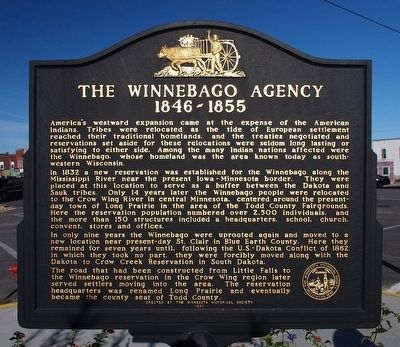
The Winnebago Agency 1846–1855
In 1832 a new reservation was established for the Winnebago along the Mississippi River near the present Iowa–Minnesota border. They were placed at this location to serve as a buffer between the Dakota and Sauk tribes. Only 14 years later the Winnebago people were relocated to the Crow Wing River in Central Minnesota, centered around the present-day town of Long Prairie in the area of the Todd County Fairgrounds. Here the reservation population numbered over 2,500 individuals, and more than 150 structures included a headquarters, school, church, convent, stores and offices.
In only nine years the Winnebago were uprooted again and moved to a new location near present-day St. Clair in Blue Earth County. Here they remained for seven years until, following the U.S.–Dakota Conflict of 1862 in which they took no part, they were forcibly moved along with the Dakota to Crow Creek Reservation in South Dakota.
The road that had been constructed
from Little Falls to the Winnebago reservation in the Crow Wing region later served settlers moving into the area. The reservation headquarters was renamed Long Prairie and eventually became the county seat of Todd County.Erected 1990 by Minnesota Historical Society.
Topics and series. This historical marker is listed in these topic lists: Native Americans • Settlements & Settlers. In addition, it is included in the Minnesota Historical Society series list. A significant historical year for this entry is 1846.
Location. 45° 58.443′ N, 94° 51.623′ W. Marker is in Long Prairie, Minnesota, in Todd County. Marker is at the intersection of Central Avenue and 3rd Street South, on the right when traveling east on Central Avenue. Touch for map. Marker is in this post office area: Long Prairie MN 56347, United States of America. Touch for directions.
Other nearby markers. At least 1 other marker is within walking distance of this marker. Todd County Courthouse Retaining Wall (about 500 feet away, measured in a direct line).
Additional keywords. Ho-Chunk
Credits. This page was last revised on June 16, 2016. It was originally submitted on October 23, 2015, by McGhiever of Minneapolis, Minnesota. This page has been viewed 853 times since then and 83 times this year. Photo 1. submitted on October 23, 2015, by McGhiever of Minneapolis, Minnesota. • Bill Pfingsten was the editor who published this page.
