
Near Sinclair in Carbon County, Wyoming — The American West (Mountains)
The Great Lincoln Highway...
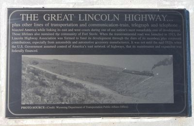
Photographed by Barry Swackhamer, September 9, 2015
1. The Great Lincoln Highway... Marker
Erected by Wyoming Recreation Commission.
Topics and series. This historical marker is listed in this topic list: Roads & Vehicles. In addition, it is included in the Lincoln Highway series list.
Location. 41° 46.702′ N, 106° 56.87′ W. Marker is near Sinclair, Wyoming, in Carbon County. It is on County Route 347 near Interstate 80, on the right when traveling west. Touch for map. Marker
this page online

Regionally, this marker is in Wyoming’s Westward Expansion Trails Region. It is also in the American Mountain West. Globally, it is in North America, the Rocky Mountains, the Western Hemisphere, the Western World, and the Anglosphere. Historically, it finds itself in what was once the Republic of Texas.
Other nearby markers. At least 8 other markers are within walking distance of this marker: This January 1880 plan of Fort Fred Steele... (here, next to this marker); The Passenger's Railroad (here, next to this marker); Wild Times In Benton! (here, next to this marker); Officer's Quarters (within shouting distance of this marker); Officers Who Commanded Fort Fred Steele (within shouting distance of this marker); Fort Steele Schoolhouse (within shouting distance of this marker); Enlisted Men's Barracks (within shouting distance of this marker); Fort Fred Steele (within shouting distance of this marker). Touch for a list and map of all markers in Sinclair.
More about this marker. This marker, among a grouping of a four
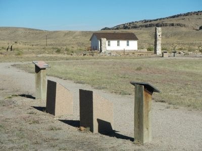
Photographed by Barry Swackhamer, September 9, 2015
2. The Great Lincoln Highway... Marker
This marker is the second from the right.
Also see . . . The Lincoln Highway in Wyoming - Tracks Across Wyoming. North Platte River: The old Lincoln Highway and US-30 steel bridge stands just north on the present bridge on I-80. Originally, Lincoln Highway motorists made use of the Union Pacific railroad bridge -- with the help of the station agent. Old Fort Steele Crossing Site on Carbon County page under Communities), a supply point during the Plains Indian Wars, stands to the north. (Submitted on October 24, 2015, by Barry Swackhamer of Brentwood, California.)
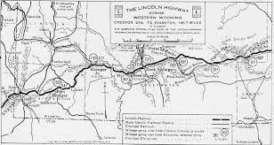
Photographed by Barry Swackhamer
3. Lincoln Highway Association
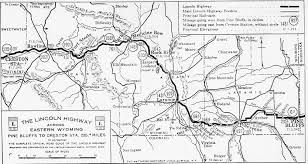
Photographed by Lincoln Highway Association
4. The Lincoln Highway in eastern Wyoming
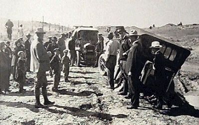
Photographed by Unknown, circa 1920
5. The Lincoln Highway in Wyoming
Credits. This page was last revised on June 16, 2016. It was originally submitted on October 24, 2015, by Barry Swackhamer of Brentwood, California. This page has been viewed 507 times since then and 22 times this year. Photos: 1, 2, 3, 4, 5. submitted on October 24, 2015, by Barry Swackhamer of Brentwood, California.
