Roebuck in Leeds and Grenville United Counties, Ontario — Central Canada (North America)
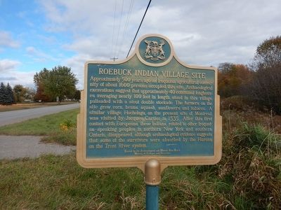
Roebuck Indian Village Site
Approximately 500 years ago an Iroquoian agricultural community of about 1600 persons occupied this site. Archaeological excavations suggested approximately 40 communal longhouses, averaging nearly 100 feet in length, stood in this village, palisaded with a stout double stockade. The farmers on the site grew corn, beans, squash, sunflowers and tobacco. A similar village, Hochelaga, on the present site of Montréal, was visited by Jacques Cartier in 1535. After this first contact with Europeans, these Indians, related to other Iroquoian-speaking peoples in northern New York and southern Ontario, disappeared, although archaeological evidence suggests that some of the survivors were absorbed by the Hurons on the Trent River system.
Erected 1974 by Archaeoligical and Historic Sites Board of Ontario.
Topics. This historical marker is listed in these topic lists: Agriculture • Native Americans.
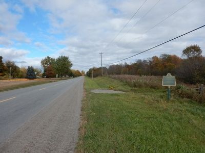
Location. 44° 48.568′ N, 75° 35.855′ W. Marker is in Roebuck, Ontario, in Leeds and Grenville United Counties. Marker is on County Route 21, one kilometer east of County Route 18, on the right when traveling east. Touch for map. Marker is at or near this postal address: 7779 County Road 21, Roebuck ON K0G 1R0, Canada. Touch for directions.
Other nearby markers. At least 8 other markers are within 13 kilometers of this marker, measured as the crow flies. The Founding of Spencerville (approx. 5.4 kilometers away); Township Hall Clock (approx. 5.4 kilometers away); War Memorial (approx. 5.4 kilometers away); Spencerville Riverside Park (approx. 5.5 kilometers away); Grand Trunk Railway (approx. 12.4 kilometers away); Grenville College (approx. 12.6 kilometers away); Parish of St. John the Evangelist Anglican Church (approx. 12.6 kilometers away); Eastern Ontario's First Court House and Gaol (approx. 12.6 kilometers away).
Credits. This page was last revised on September 27, 2019. It was originally submitted on October 26, 2015, by Kevin Craft of Bedford, Quebec. This page has been viewed 562 times since then and 40 times this year. Photos: 1, 2. submitted on October 26, 2015, by Kevin Craft of Bedford, Quebec.

