Near Farson in Sweetwater County, Wyoming — The American West (Mountains)
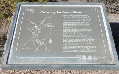
Crossing the Green River
The Oregon Trail
Inscription.
Crossing rivers was the most dangerous activity emigrants faced on their journey west. By the time weary pioneers enroute (sic) to Oregon, California, or Utah reached the east bank of the Green River, they had been on the trail for several months. Utah was close, but those going to Oregon or California were only halfway there.
Though crossing the Green had its perils, most emigrants were happy to see the cool water and lush cottonwood groves with grass for their hungry animals, firewood instead of buffalo chips, and the chance to camp under trees - a rare opportunity in western Wyoming.
Before spring runoff and in late summer when the water level of the Green was low, fords provided relatively safe crossings. However, most emigrants reached the Green River at the height of its annual flood when it flowed swift, wide and deep.
Several enterprising pioneers settled along the river and established ferries to float emigrant wagons across. Ferry prices were usually high ranging from $3 to $16 per wagon and were virtually the only way to cross the river. Ferry prices sometimes changed daily to correspond with the changes in the river level. It often took several days for large wagon trains to cross the river.
As the number of people headed west swelled into tens of thousands each year, the number of ferries on the Green increased also. As many as 50 ferries are thought to have operated along the 50-mile corridor of the Green River Valley crossed by emigrant trails.
Erected by U.S. Department of the Interior, Bureau of Land Management and U.S. Fish & Wildlife Service.
Topics and series. This historical marker is listed in these topic lists: Roads & Vehicles • Settlements & Settlers. In addition, it is included in the Oregon Trail series list.
Location. 41° 52.809′ N, 109° 48.447′ W. Marker is near Farson, Wyoming, in Sweetwater County. Marker is on State Highway 28 at milepost 102 near State Highway 372, on the right when traveling east. Touch for map. Marker is in this post office area: Farson WY 82932, United States of America. Touch for directions.
Other nearby markers. At least 8 other markers are within 13 miles of this marker, measured as the crow flies. Ferrying Across the Green River (a few steps from this marker); The Lombard Ferry (a few steps from this marker); Overland to Zion (a few steps from this marker); One Day at a Time (within shouting distance of this marker); Seedskadee National Wildlife Refuge (within shouting distance of this marker); "Graves" of the Unknown Emigrants (approx. 12˝ miles away); Burial on the Trail (approx. 12˝ miles away); Death on the Trail (approx. 12˝ miles away). Touch for a list and map of all markers in Farson.
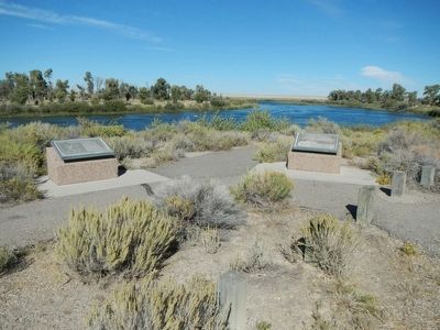
More about this marker. This marker is found at a viewing area in Seedsskadee National Wildlife Refuge. The viewing area is located downstream (south) of west end of the bridge over the Green River.
Credits. This page was last revised on June 16, 2016. It was originally submitted on October 27, 2015, by Barry Swackhamer of Brentwood, California. This page has been viewed 1,370 times since then and 159 times this year. Photos: 1, 2. submitted on October 27, 2015, by Barry Swackhamer of Brentwood, California.

