East Irondequoit in Monroe County, New York — The American Northeast (Mid-Atlantic)
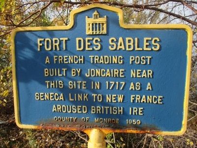
Fort Des Sables
A French trading post
built by Joncaire near
this site in 1717 as a
Seneca link to New France.
Aroused British ire.
Erected 1959 by County of Monroe.
Topics. This historical marker is listed in these topic lists: Forts and Castles • Native Americans. A significant historical year for this entry is 1717.
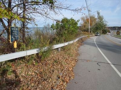
Location. 43° 14.091′ N, 77° 32.547′ W. Marker is in Irondequoit, New York, in Monroe County. It is in East Irondequoit. Marker is on Culver Road (County Route 120) east of Lake Bluff Road, on the left when traveling east. Touch for map. Marker is in this post office area: Rochester NY 14622, United States of America. Touch for directions.
Other nearby markers. At least 8 other markers are within walking distance of this marker. On This Site - Over the Years (about 400 feet away, measured in a direct line); a different marker also named On This Site - Over the Years (about 400 feet away); a different marker also named On This Site - Over the Years (about 500 feet away); a different marker also named On This Site - Over the Years (about 500 feet away); The Jack Rabbit (about 600 feet away); The Leopold Lion (about 600 feet away); The Seabreeze Time Line (about 700 feet away); a different marker also named On This Site - Over the Years (about 700 feet away). Touch for a list and map of all markers in Irondequoit.

Photographed By Anton Schwarzmueller, October 31, 2015
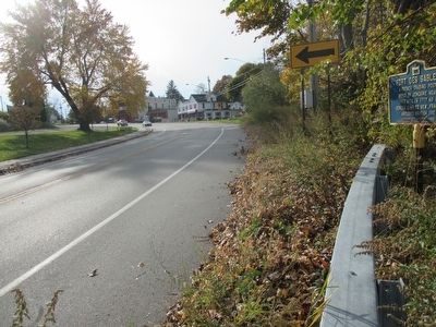
2. Eastward
Marker is at the edge of a bluff overlooking Lake Ontario. In this direction, Culver Road ends at the entrance to Irondequoit Bay, where a manually rotating bridge, to cross the bay entrance, stays in the retracted position during the boating season. The bay is to the right of the road in the background.
Credits. This page was last revised on February 16, 2023. It was originally submitted on November 1, 2015, by Anton Schwarzmueller of Wilson, New York. This page has been viewed 693 times since then and 136 times this year. Photos: 1, 2, 3. submitted on November 1, 2015, by Anton Schwarzmueller of Wilson, New York.

