Green River in Sweetwater County, Wyoming — The American West (Mountains)
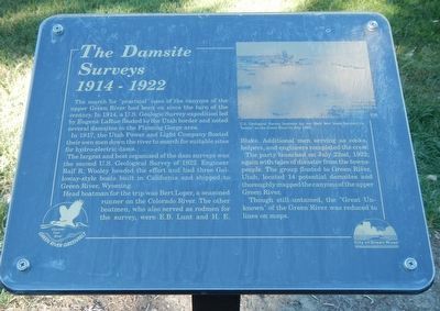
The Damsite Surveys
1914-1922
Inscription.
The search for "practical" uses of the canyons of the upper Green River had been on since the turn of the century. In 1914, a U.S. Geologic Survey expedition led by Eugene LaRue floated to the Utah border and noted several damsites in the Flaming Gorge area.
In 1917, the Utah Power and Light Company floated their own men down the river to search for suitable sites for hydro-electric dams.
The largest and best organized of the dam surveys was the second U.S. Geological Survey of 1922. Engineer Ralf R. Wooley headed the effort and had three Galloway-style boats built in California and shipped to Green River, Wyoming.
Head boatman for the trip was Bert Loper, a seasoned runner on the Colorado River. The other boatmen, who also served as rodmen for the survey, were E.B. Lunt and H.E. Blake. Additional men serving as cooks, helpers, and engineers completed the crew. The party launched on July 22nd, 1922; again with tales of disaster from the townspeople. The group floated to Green River, Utah, located 14 potential damsites and thoroughly mapped the canyons of the upper Green River.
Though still untamed, the "Great Unknown" of the Green River was reduced to lines on maps.
Erected by Green River Greenbelt and City of Green River.
Topics. This historical marker is listed in these topic lists: Exploration • Waterways & Vessels.
Location. 41° 31.416′ N, 109° 28.286′ W. Marker is in Green River, Wyoming, in Sweetwater County. Marker can be reached from South 2nd East Street, on the right when traveling south. Touch for map. Marker is at or near this postal address: 398 South 2nd East Street, Green River WY 82935, United States of America. Touch for directions.
Other nearby markers. At least 8 other markers are within walking distance of this marker. Kolb Brothers (here, next to this marker); Buzz Holstrom (within shouting distance of this marker); Julius Stone (within shouting distance of this marker); Major Wesley Powell and Party (within shouting distance of this marker); William Manly - 1849 (within shouting distance of this marker); The Great Unknown (within shouting distance of this marker); John Wesley Powell, 1871 (within shouting distance of this marker); William Ashley - 1825 (within shouting distance of this marker). Touch for a list and map of all markers in Green River.
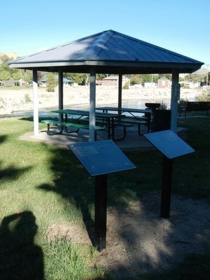
More about this marker. This marker is located next to the perimeter walking path in Island Park. Island Park occupies the northwestern end of Expedition Island and is across the bridge at the south end of South 2nd East Street.
Credits. This page was last revised on June 16, 2016. It was originally submitted on November 1, 2015, by Barry Swackhamer of Brentwood, California. This page has been viewed 297 times since then and 10 times this year. Photos: 1, 2. submitted on November 1, 2015, by Barry Swackhamer of Brentwood, California.

