Sayre in Bradford County, Pennsylvania — The American Northeast (Mid-Atlantic)
Pine Plains
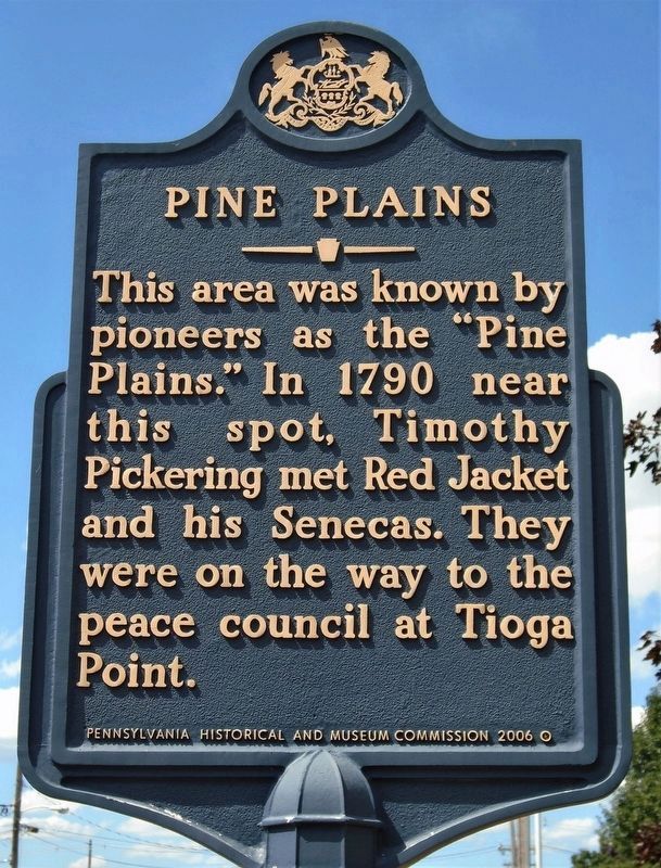
Photographed by William Fischer, Jr., July 28, 2020
1. Pine Plains Marker
Erected 1947 by Pennsylvania Historical & Museum Commission.
Topics and series. This historical marker is listed in these topic lists: Indigenous Peoples and Communities • Settlements & Settlers. In addition, it is included in the Pennsylvania Historical and Museum Commission (PHMC) series list. A significant historical year for this entry is 1790.
Location. 41° 59.415′ N, 76° 31.701′ W. Marker is in Sayre, Pennsylvania, in Bradford County. It is on North Keystone Avenue. The marker is in front of the First Church of God. Touch for map. Marker is at or near this postal address: 416 North Keystone Avenue, Sayre PA 18840, United States of America. Touch for directions.

Regionally, this marker is in the American Northeast and in the Mid-Atlantic. Globally, it is in North America, the Western Hemisphere, the Western World, and the Anglosphere. Historically, it finds itself in what was once the Haudenosaunee (Iroquois) Confederacy
this page online
Other nearby markers. At least 8 other markers are within walking distance of this marker: Milltown (approx. 0.6 miles away); Guthrie Square (approx. 0.8 miles away); Lehigh Valley Railroad (approx. 0.8 miles away); The Bandstand in Howard Elmer Park (approx. 0.9 miles away); World War I Doughboy (approx. 0.9 miles away); Sayre Borough Hall (approx. 0.9 miles away); A Horse Town, the Freight Station, and the Desmond Street Clock (approx. one mile away); Sayre, A Boomtown (approx. one mile away). Touch for a list and map of all markers in Sayre.
Photographed by Don Morfe, October 13, 2015
2. Pine Plains Marker
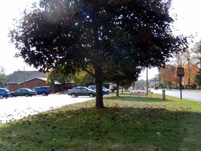
Photographed by Don Morfe, October 13, 2015
3. Pine Plains Marker
Credits. This page was last revised on July 29, 2020. It was originally submitted on November 3, 2015, by Don Morfe of Baltimore, Maryland. This page has been viewed 529 times since then and 17 times this year. Photos: 1. submitted on July 29, 2020, by William Fischer, Jr. of Reynoldsburg, Ohio. 2, 3. submitted on November 3, 2015, by Don Morfe of Baltimore, Maryland. • Bill Pfingsten was the editor who published this page.
