Buckner in Jackson County, Missouri — The American Midwest (Upper Plains)
Fort Osage
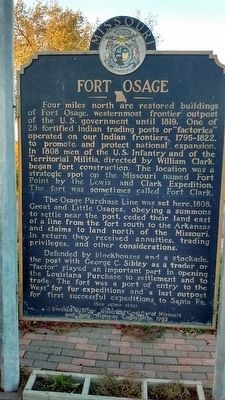
Four miles north are restored buildings of Fort Osage, westernmost frontier outpost of the U.S. government until 1819. One of 28 fortified Indian trading posts or "factories" operation on our Indian frontiers, 1795-1822, to promote and protect national expansion. In 1808 men of the U.S. Infantry and of the Territorial Militia, directed by William Clark, began fort construction. The location was a strategic spot on the Missouri named Fort Point by the Lewis and Clark Expedition. The fort was sometimes called Fort Clark.
The Osage Purchase Line was set here, 1808. Great and Little Osages, obeying a summons to settle near the post, ceded their land east of a line from the fort south to the Arkansas and claims to the land north of the Missouri. In return, they received annuities, trading privileges, and other considerations.
Defended by blockhouses and a stockade, the post with George C. Sibley as a trader or "factor" played an important part in opening the Louisiana Purchase to settlement and to trade. the fort was a port of entry to the West for fur expeditions and a last outpost for first successful expeditions to Santa Fe.
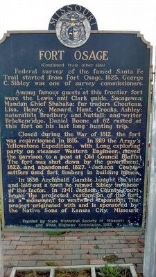
Federal survey of the famed Santa Fe Trail started from Fort Osage, 1825. George C. Sibley was one of survey commissioners.
Among famous guests at this frontier fort were the Lewis and Clark guide, Sacagawea; Manda Chief Shahaka; fur traders Chouteau, Lisa, Henry, Menard, Hunt, Crooks, Ashley; naturalist Bradbury and Nuttall; and writer Brackenridge. Daniel Boone at 82 rested at this fort on his last long hunting trip.
Closed during the War of 1812, the fort was regarrisoned in 1815. In 1819 the Army's Yellowstone Expedition, with Long exploring party on steamer Western Engineer, moved the garrison to a post at Old Council Bluffs. The fort was shut down by the government, 1822, and abandoned, 1827. Jackson County settlers used fort timbers in building homes.
In 1836 Archibald Gamble bought the site and laid out a town he named Sibley in honor of the factor. In 1941 Jackson County Court began the projected restoration of the Fort as a monument to westward expansion. the project originated with and is sponsored by the Native Sons of Kansas City, Missouri.
Erected 1953 by Historical Society of Missouri and State Highway Commission.
Topics and series. This historical marker is listed in these topic lists: Exploration • Forts and Castles • Native Americans. In addition, it is included in the Missouri, The State Historical Society of series list. A significant historical year for this entry is 1808.
Location. 39° 8.639′ N, 94° 11.778′ W. Marker is in Buckner, Missouri, in Jackson County. Marker is on Buckner-Tarsney Road, on the right when traveling north. The Fort Osage marker is located at the entrance to Cecil Baker Memorial Field. Touch for map. Marker is in this post office area: Buckner MO 64016, United States of America. Touch for directions.
Other nearby markers. At least 8 other markers are within 7 miles of this marker, measured as the crow flies. Santa Fe Trail (approx. 0.4 miles away); a different marker also named Fort Osage (approx. 2.9 miles away); Events at Fort Osage (approx. 3 miles away); Restoration of Fort Osage (approx. 3 miles away); a different marker also named Santa Fe Trail (approx. 5.1 miles away); Trail of Death (approx. 6.2 miles away); Engagement at the Little Blue (approx. 6.3 miles away); Potawatomi Trail of Death March (approx. 6.7 miles away).
Credits. This page was last revised on January 1, 2022. It was originally submitted on November 7, 2015, by Tom Bosse of Jefferson City, Tennessee. This page has been viewed 497 times since then and 26 times this year. Photos: 1, 2. submitted on November 7, 2015, by Tom Bosse of Jefferson City, Tennessee. • Bill Pfingsten was the editor who published this page.

