Near The Rock in Upson County, Georgia — The American South (South Atlantic)
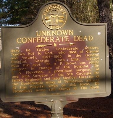
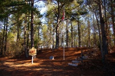
Unknown Confederate Dead
Erected 1955 by Georgia Historical Commission. (Marker Number 145-2.)
Topics and series. This historical marker is listed in these topic lists: Cemeteries & Burial Sites • War, US Civil. In addition, it is included in the Georgia Historical Society series list. A significant historical year for this entry is 1865.
Location. 32° 57.308′ N, 84° 14.474′ W. Marker is near The Rock, Georgia, in Upson County. Marker is on The Rock Road, one mile south of The Rock Road (Georgia Route 36), on the left when traveling south. Located on The Rock Road, one mile south of the town of The Rock, located on Georgia Highway 36. Touch for map. Marker is in this post office area: The Rock GA 30285, United States of America. Touch for directions.
Other nearby markers. At least 8 other markers are within 8 miles of this marker, measured as the crow flies. First Post Office (approx. 0.9 miles away); Trice Cemetery (approx. 4½ miles away); General John B. Gordon (approx. 6.8 miles away); Upson Confederate Memorial (approx. 6.8 miles away); First Cannon Ball (approx. 6.8 miles away); Upson County (approx. 6.8 miles away); Confederate Dead (approx. 6.9 miles away); Pettigrew-White-Stamps House (approx. 7.3 miles away).
Credits. This page was last revised on June 16, 2016. It was originally submitted on July 10, 2008, by David Seibert of Sandy Springs, Georgia. This page has been viewed 1,577 times since then and 38 times this year. Photos: 1, 2. submitted on July 10, 2008, by David Seibert of Sandy Springs, Georgia. • Craig Swain was the editor who published this page.

