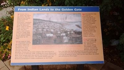
From Indian Lands to the Golden Gate
The Lewis and Clark Expedition opened the area to American fur traders. Pioneers followed soon after. The first to migrate through here were the Mormons. Persecuted for their religion, they were force to leave Illinois in February 1846, crossing the frozen Mississippi River. Four months later they arrived, discouraged and tired, at what today is called Florence. the Omaha Indians gave the Mormons permission to build a settlement on their land.
Winter Quarters was built as a temporary city for about 4,000 Mormons they spent two years renewing their strength and confidence. They ordained a President and prepared to continue their journey to religious freedom. In 1848, the Mormons abandoned their city, leaving behind a mill, cemetery, and a network of roads, bridges and ferries.
One year later, in 1849, California gold was discovered and "gold fever" infected the nation. thousands of "gold rushers" traveled the Mormon Trail through here. By 1852, the North Mormon Ferry became known as
the "Golden Gate" because of the large numbers of gold rushers crossing the Missouri River. This was the land where the fabled and adventurous West began.Topics and series. This historical marker is listed in this topic list: Settlements & Settlers. In addition, it is included in the Lewis & Clark Expedition, and the Mormon Pioneer Trail series lists. A significant historical year for this entry is 1804.
Location. 41° 20.264′ N, 95° 57.639′ W. Marker is in Florence, Nebraska, in Douglas County. It is in North Omaha. Marker is on 30th Street, on the right when traveling north. Touch for map. Marker is in this post office area: Omaha NE 68112, United States of America. Touch for directions.
Other nearby markers. At least 8 other markers are within walking distance of this marker. A Little Town That Dreamed of Greatness (here, next to this marker); The Bank of Florence (within shouting distance of this marker); Mormon Pioneer Memorial Bridge (within shouting distance of this marker); Winter Quarters (about 700 feet away, measured in a direct line); The Mormon Pioneer Trail (approx. 0.3 miles away); A Meeting House for the Saints (approx. 0.3 miles away); The Florence Mill (approx. 0.4 miles away); a different marker also named The Florence Mill (approx. 0.4 miles away). Touch for a list and map of all markers in Florence.
Credits. This page was last revised on February 16, 2023. It was originally submitted on November 12, 2015, by Tom Bosse of Jefferson City, Tennessee. This page has been viewed 525 times since then and 12 times this year. Photo 1. submitted on November 12, 2015, by Tom Bosse of Jefferson City, Tennessee. • Bill Pfingsten was the editor who published this page.
Editor’s want-list for this marker. A wide shot of the marker and its surroundings. • Can you help?
