Florence in Omaha in Douglas County, Nebraska — The American Midwest (Upper Plains)
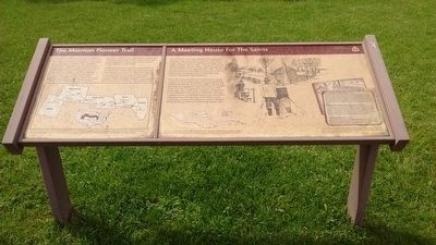
The Mormon Pioneer Trail
⎯⎯⎯
A Meeting House For The Saints
Photographed by Tom Bosse, September 8, 2015
1. The Mormon Pioneer Trail Marker
Following a rough trace blazed by earlier explorers, fur traders and missionaries, this pioneering group began laying out a route to the West that would later be used by thousands of other Mormons and Forty-niners. These first pioneers established ferries, campsites, bridges and supply depots - improvements that earned
this page online
The Pioneers of the Mormon Trail struggled across mid-America crossing the Iowa Prairie, traversing the Great Plains across Nebraska, climbing the backbone of the continental divide at South Pass, Wyoming and descending the western slopes of the Rocky Mountains to the Great Salt Lake Valley of Utah.
The 22 by 32 foot town hall, or "Council House, was the social center of the refugee camp. Here, social gatherings, religious meetings and dances helped lighten the hearts of the Saints allowing them to temporarily forget the cold and misery of winter. The log structure
Photographed by Tom Bosse, September 8, 2015
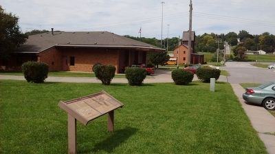
2. The Mormon Pioneer Trail Marker
The Florence Mill can be seen in the background.
Topics and series. This historical marker is listed in these topic lists: Roads & Vehicles • Settlements & Settlers. In addition, it is included in the Mormon Pioneer Trail series list. A significant historical month for this entry is February 1846.
Location. 41° 20.55′ N, 95° 57.735′ W. Marker is in Omaha, Nebraska, in Douglas County. It is in Florence. It is on North 30th Street, on the right when traveling south. Touch for map. Marker is at or near this postal address: 9090 N 30th St, Omaha NE 68112, United States of America. Touch for directions.

Regionally, this marker is in Eastern Nebraska. It is also in the American Midwest, in the Lewis & Clark Corridor, in the Corn Belt, and on the prairies. Globally, it is in North America, the Western Hemisphere, the Western World, and the Anglosphere. Historically, it finds itself in what was once the Louisiana Purchase.
Other nearby markers. At least 8 other markers are within walking distance of this marker: A Meeting House for the Saints (here, next to this marker); The Florence Mill (about 400 feet away, measured in a direct line); The Road to Zion (about 400 feet away); Crossroads to the West: (about 500 feet away); Mormon Pioneer Memorial Bridge (approx. ¼ mile away); From Indian Lands to the Golden Gate (approx. 0.3 miles away); A Little Town That Dreamed of Greatness (approx. 0.3 miles away); The Bank of Florence (approx. 0.4 miles away). Touch for a list and map of all markers in Omaha.
Another marker is no longer nearby. The Florence Mill (was about 400 feet away but has been confirmed missing).
Credits. This page was last revised on November 20, 2024. It was originally submitted on November 12, 2015, by Tom Bosse of Jefferson City, Tennessee. This page has been viewed 1,117 times since then and 49 times this year. Last updated on November 14, 2015, by Keith S Smith of West Chester, Pennsylvania. Photos: 1, 2. submitted on November 12, 2015, by Tom Bosse of Jefferson City, Tennessee. • Andrew Ruppenstein was the editor who published this page.
Editor’s want-list for this marker. Add the rest of the marker text from the right side. • Can you help?
