Dyer in Lake County, Indiana — The American Midwest (Great Lakes)
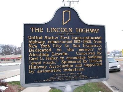
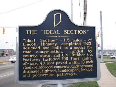
The Lincoln Highway / The "Ideal Section"
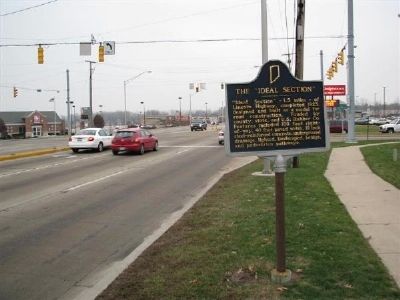
Approximate Western-extent of the "Ideal Section"
The Lincoln Highway. United States' first transcontinental highway, constructed 1913-1928, from New York City to San Francisco. Dedicated to the memory of Abraham Lincoln. Conceived by Carl G. Fisher to encourage building "good roads." Sponsored by Lincoln Highway Association and supported by automotive industries.
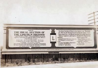
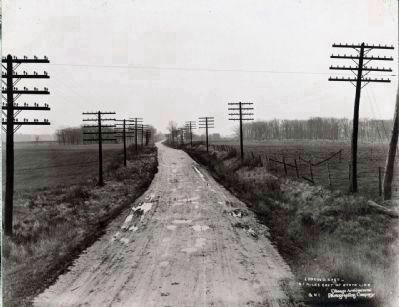
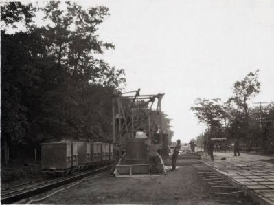
The "Ideal Section". "Ideal Section" - 1.5 miles - of Lincoln Highway, completed 1923, designed and built as a model for road construction. Funded by county, state, and U.S. Rubber Co. Features included 100 foot right-of-way, 40 foot paved width, 10 inch steel-reinforced concrete, underground drainage, lighted, landscaped, bridge, and pedestrian pathways.
Erected 1996 by Indiana Historical Bureau, Northwest Indiana Lincoln Highway Association, Dyer and Schererville Historical Societies, Sand Ridge Bank, Welsh, Inc. (Marker Number 45.1996.2.)
Topics and series. This historical marker is listed in these topic lists: Charity & Public Work • Industry & Commerce • Roads & Vehicles. In addition, it is included in the Indiana Historical Bureau Markers, and the Lincoln Highway series lists. A significant historical year for this entry is 1923.
Location. 41° 29.571′ N, 87° 30.579′ W. Marker is in Dyer, Indiana, in Lake County. Marker is on US-30, Lincoln Highway, Joliet Street (U.S. 30), on the right when traveling east. This marker designates the approximate Western-extent of the "Ideal Section". A duplicate marker designates the approximate Eastern-extent of the "Ideal Section" about 1.5 miles to the east. Touch for map. Marker is at or near this postal address: 718 Joliet St, Dyer, IN 46311, Dyer IN 46311, United States of America. Touch for directions.
Other nearby markers. At least 8 other markers are within 3 miles of this marker, measured as the crow flies. Sauk (Sak) Trail (approx. 0.6 miles away); The Ideal Section Of The Lincoln Highway (approx. 0.6 miles away); The Lincoln Highway (approx. 0.6 miles away); St. John Township School District #2 (approx. 1.1 miles away); a different marker also named The Lincoln Highway / The "Ideal Section" (approx. 1˝ miles away); Lincoln Highway - Ideal Section - 1923 (approx. 1˝ miles away); a different marker also named The Lincoln Highway (approx. 2.2 miles away); Sauk Village (approx. 2.4 miles away in Illinois). Touch for a list and map of all markers in Dyer.
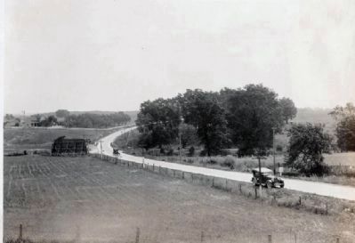
Regarding The Lincoln Highway / The "Ideal Section". This marker is near the west end of the "Ideal Section" which runs for a large portion of the two miles between Calumet Ave. (in Dyer) and Indianapolis Blvd. (in Schererville). This marker is one of four markers on the "Ideal Section" along with two decorated "Lincoln Highway Bridges" over Dyer Ditch and Plum Creek.
Also see . . .
1. The Lincoln Highway. A brief history by Richard F. Weingroff and hosted by the Federal Highway Administration.
"In 1920, the LHA decided to develop a model section of road that would be adequate not only for current traffic but for highway transportation over the following 2 decades." (Submitted on July 11, 2008, by Kevin W. of Stafford, Virginia.)
2. Lincoln Highway Association. pick a state - loads of information from coast to coast. (Submitted on July 12, 2008, by Al Wolf of Veedersburg, Indiana.)
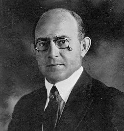
3. Carl G. Fisher. Mentioned on the marker, he was the driving force to bring about the Lincoln Highway. He also owned the Indianapolis 500 Race Track and invested in many things. A man of action - he enjoyed activity. (Submitted on July 12, 2008, by Al Wolf of Veedersburg, Indiana.)
Credits. This page was last revised on December 29, 2022. It was originally submitted on July 11, 2008, by Kevin W. of Stafford, Virginia. This page has been viewed 2,930 times since then and 43 times this year. Last updated on December 29, 2022, by Lou Donkle of Valparaiso, Indiana. Photos: 1, 2, 3. submitted on July 11, 2008, by Kevin W. of Stafford, Virginia. 4, 5. submitted on January 23, 2010, by Al Wolf of Veedersburg, Indiana. 6, 7. submitted on January 24, 2010, by Al Wolf of Veedersburg, Indiana. 8. submitted on July 12, 2008, by Al Wolf of Veedersburg, Indiana. • Devry Becker Jones was the editor who published this page.
