Near Frog Level in Tazewell County, Virginia — The American South (Mid-Atlantic)
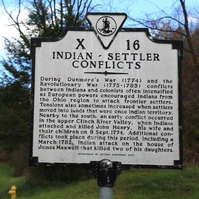
Indian-Settler Conflicts
Erected 2001 by Department of Historic Resources. (Marker Number X-16.)
Topics and series. This historical marker is listed in these topic lists: Settlements & Settlers • Wars, US Indian. In addition, it is included in the Virginia Department of Historic Resources (DHR), and the Virginia, Clinch River Forts Circa 1774 series lists. A significant historical year for this entry is 1774.
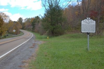
Location. 37° 6.073′ N, 81° 33.141′ W. Marker is near Frog Level, Virginia, in Tazewell County. Marker is on Crab Orchard Road (Business U.S. 19) east of B F Buchanan Highway (Virginia Route 16), on the left when traveling south. Touch for map. Marker is in this post office area: Tazewell VA 24651, United States of America. Touch for directions.
Other nearby markers. At least 8 other markers are within 5 miles of this marker, measured as the crow flies. Big Crab Orchard or Witten’s Fort (approx. 1.7 miles away); Tazewell (approx. 1.7 miles away); Fincastle Turnpike (approx. 1.8 miles away); Pisgah United Methodist Church (approx. 1.8 miles away); The James Wynn House (approx. 2.1 miles away); William Wynne’s Fort (approx. 3.6 miles away); Roark’s Gap Incident (approx. 4.3 miles away); First Court for Tazewell County (approx. 4.3 miles away).
More about this marker. This marker replaced an earlier marker with the same number at this location, but titled “Indian Outrage.” The text of that marker, erected after 1930, read “Four miles south the first Indian attack in the Upper Clinch Valley took place, September 8, 1774. John Henry was wounded and his wife and children were carried into captivity. In 1781, Indians attacked the house of Robert Maxwell, near here, and killed two girls.”
Credits. This page was last revised on March 4, 2022. It was originally submitted on November 16, 2015, by J. J. Prats of Powell, Ohio. This page has been viewed 713 times since then and 28 times this year. Photos: 1, 2. submitted on November 16, 2015, by J. J. Prats of Powell, Ohio.
Editor’s want-list for this marker. Photo of the earlier marker. • Can you help?

