Near Elkhorn City in Pike County, Kentucky — The American South (East South Central)
Russell Fork Overlook
— Breaks Interstate Park —
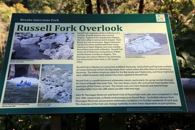
Russell Fork is tributary to Levisa Fork at Millard, Kentucky. Levisa Fork and Tug Fork combine at Louisa, Kentucky to form the Big Sandy River, which enters the Ohio River at Catlettsburg Kentucky. The Native American name for the Big Sandy was Chatterwha, and these highlands were called Ouasioto; both names have been applied to Russell Fork.
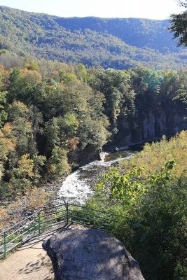
Russell Fork is a world-renowned whitewater stream, particularly the gorge section through the heart of Breaks Interstate Park. The river drops nearly 280 vertical feet from Garden Hole upstream of the Towers, to here. The stream runs over bare bedrock and around large boulders fallen from the cliffs which are 800-1000 feet high.
John W. Flannagan Reservoir and North Fork of Pound Dam and Lake were completed in 1964 and 1966, respectively, as flood control projects on Pound River. Controlled releases from Flannagan Reservoir assure prime whitewater conditions on October weekends of each year. The character of the river can change markedly at other times dependent on precipitation.
Erected by Breaks Interstate Park.
Topics. This historical marker is listed in this topic list: Natural Features.
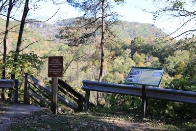
Location. 37° 18.014′ N, 82° 19.301′ W. Marker is near Elkhorn City, Kentucky, in Pike County. Marker is on Patty Loveless Drive (Kentucky Route 80), on the right when traveling east. It is closer to the Virginia State Line than to Elkhorn City. There is a pull-off on Route 80 with parking signed for Russel Fork Overlook. Touch for map. Marker is in this post office area: Elkhorn City KY 41522, United States of America. Touch for directions.
Other nearby markers. At least 8 other markers are within 2 miles of this marker, measured as the crow flies. Known But to God (approx. half a mile away); Richard Potter (approx. 1.3 miles away); Clinchfield Overlook (approx. 1.3 miles away in Virginia); The Name Breaks (approx. 1.4 miles away in Virginia); William Ramey (approx. 1.7 miles away); Early Settlement (approx. 1.7 miles away in Virginia); Salt Kettle (approx. 1.7 miles away in Virginia); Elkhorn City’s Railroads (approx. 1.7 miles away). Touch for a list and map of all markers in Elkhorn City.
More about this marker. The interpretative panel includes a map in the upper right showing the Russell Fork drainage basin. to the left are three photos captioned “Boulders and bedrock in Russell Fork,” “Tunnel discharge from Flannagan Dam,” and “Kayaks at the Towers.” Acknowledgements include, “Narrative by Tony Scales, Geologist and Author of ‘The Breaks: Grand Canyon of the South’ made possible by a generous contribution from A.M. Smiley Ratliff and the Ratcliffe Foundation.” Map: “Jen Krstolic, US Geological Survey.” Photos: “Paul B. Mays” and “Lance Hill.”
Also see . . . Wikipedia Entry for Breaks Interstate Park. “Breaks Interstate Park is a bi-state state park located in southeastern Kentucky and southwestern Virginia in the Jefferson National Forest at the northeastern terminus of Pine Mountain. It is administered by the states of Virginia and Kentucky and is one of several interstate parks in the United States. The Breaks, also referred as the ‘Grand Canyon of the South,’ is the deepest gorge east of the Mississippi River, through which the Russell Fork river and Clinchfield Railroad (now the CSX Transportation Kingsport Subdivision) run. It is accessed via Virginia State Route 80, between Haysi, Virginia and Elkhorn City, Kentucky, and passes through the community of Breaks, Virginia east of the park. American frontiersman Daniel Boone is credited with being the first person of European descent to discover the Breaks, which he first saw in 1767.” (Submitted on November 16, 2015.)
Credits. This page was last revised on June 16, 2016. It was originally submitted on November 16, 2015, by J. J. Prats of Powell, Ohio. This page has been viewed 621 times since then and 30 times this year. Photos: 1, 2, 3, 4. submitted on November 16, 2015, by J. J. Prats of Powell, Ohio.


