Pound Gap in Wise County, Virginia — The American South (Mid-Atlantic)
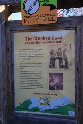
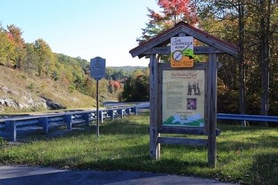
The Crooked Road
— The Crooked Road — Virginia’s Heritage Music Trail —
Old time mountain music, bluegrass, and gospel can be enjoyed all year long and several museums are devoted to showcasing the area’s rich musical heritage.
The Crooked Road winds through the ruggedly beautiful Appalachian Mountains and leads you to the major hotspots of old time mountain, music country music, and bluegrass. Alive and kickin’ for today’s fans, these venues preserve and celebrate musical traditions passed down through generations. Annual festivals, weekly concerts, radio shows, and jam sessions ring out to large audiences and intimate gatherings. Please visit the Crooked Road website to plan your trip to coincide with the current entertainment events.
Erected by The Crooked Road.
Topics and series. This historical marker is listed in these topic lists: Arts, Letters, Music • Entertainment • Roads & Vehicles. In addition, it is included in the The Crooked Road: Virginia’s Heritage Music Trail series list.
Location. 37° 9.33′ N, 82° 37.383′ W. Marker is in Pound Gap, Virginia, in Wise County. Marker is at the intersection of Orby Cantrell Highway (U.S. 23) and Potter Town Road (County Route 667), on the right when traveling south on Orby Cantrell Highway. Touch for map. Marker is in this post office area: Pound VA 24279, United States of America. Touch for directions.
Other nearby markers. At least 8 other markers are within walking distance of this marker. Daniel Webster Dotson (here, next to this marker); Pound Gap Engagement (within shouting distance of this marker); Pound Gap (approx. 0.4 miles away); Leonard Woods Lynched (approx. 0.4 miles away); Wise County / Kentucky (approx. half a mile away); Caudill’s Army (approx. 0.6 miles away in Kentucky); Brothers Once More (approx. 0.6 miles away in Kentucky); Pound Gap Massacre (approx. 0.6 miles away in Kentucky). Touch for a list and map of all markers in Pound Gap.
Credits. This page was last revised on January 9, 2020. It was originally submitted on November 20, 2015, by J. J. Prats of Powell, Ohio. This page has been viewed 509 times since then and 28 times this year. Photos: 1, 2. submitted on November 20, 2015, by J. J. Prats of Powell, Ohio.

