Near Mason in Mason County, Texas — The American South (West South Central)
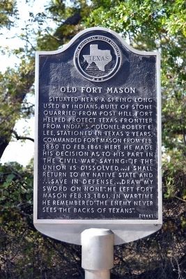
Old Fort Mason
Situated near a spring long used by Indians; built of stone quarried from Post Hill. Fort helped protect Texas frontier from Indians. Colonel Robert E. Lee stationed in Texas 2 years, commanded Fort Mason from Feb. 1860 to Feb. 1861. Here he made his decision as to his part in the Civil War, saying: “If the Union is dissolved, ... I shall return to my native state and ... save in defense ... draw my sword on none”. He left Fort Mason Feb. 13, 1861. In wartime he remembered “The enemy never sees the back of Texans”.
Erected 1965 by State Historical Survey Committee. (Marker Number 11276.)
Topics. This historical marker is listed in these topic lists: Forts and Castles • War, US Civil • Wars, US Indian. A significant historical month for this entry is February 1860.
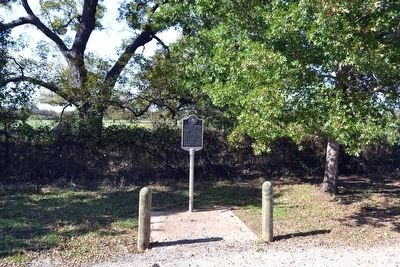
Location. 30° 45.905′ N, 99° 14.788′ W. Marker is near Mason, Texas, in Mason County. Marker is on U.S. 87, 0.1 miles north of U.S. 377, on the left when traveling north. Touch for map. Marker is in this post office area: Mason TX 76856, United States of America. Touch for directions.
Other nearby markers. At least 8 other markers are within 2 miles of this marker, measured as the crow flies. Koocksville (approx. 0.6 miles away); Two Sheriffs of Mason County (approx. 0.8 miles away); St. Joseph's Catholic Church (approx. 1.1 miles away); The Lindsay House (approx. 1.1 miles away); The Whorlie Well (approx. 1.2 miles away); Spring Street Church (approx. 1.2 miles away); First Comanche-German Meeting (approx. 1.2 miles away); Broad Street Bridge (approx. 1.2 miles away). Touch for a list and map of all markers in Mason.
Also see . . . Fort Mason. From the Texas State Historical Association’s “Handbook of Texas Online”. (Submitted on November 25, 2015.)
Credits. This page was last revised on November 28, 2020. It was originally submitted on November 25, 2015, by Duane Hall of Abilene, Texas. This page has been viewed 620 times since then and 56 times this year. Photos: 1, 2, 3, 4. submitted on November 25, 2015, by Duane Hall of Abilene, Texas.


