Riceboro in Liberty County, Georgia — The American South (South Atlantic)
Riceborough
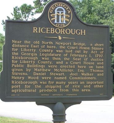
Photographed by Mike Stroud, July 2008
1. Riceborough Marker
Riceborough was for many years an important port for the shipping of rice and other agricultural products from this area.
Erected 1957 by Georgia Historical Commission. (Marker Number 089-13.)
Topics and series. This historical marker is listed in this topic list: Colonial Era. In addition, it is included in the Georgia Historical Society series list. A significant historical month for this entry is February 1701.
Location. 31° 44.709′ N, 81° 26.394′ W. Marker is in Riceboro, Georgia, in Liberty County. It is at the intersection of Ocean Highway (U.S. 17) and Walthorville-Riceboro Road (State Highway 119), on the right when traveling north on Ocean Highway. Touch for map. Marker is in this post office area: Riceboro GA 31323, United States
this page online

Regionally, this marker is on the Coastal Plain and on the Georgia Coast and the Golden Isles. It is also in the American South, specifically in the Deep South, and on the Eastern Seaboard. Globally, it is in the North Atlantic Region, North America, the Western Hemisphere, the Western World, and the Anglosphere. Historically, it finds itself in what was once New Spain, the territory of the Mississippian Culture, one of the original Thirteen Colonies, one of the Confederate States of America, and the Antebellum South.
Other nearby markers. At least 8 other markers are within 4 miles of this marker, measured as the crow flies: "Lest We Forget" (approx. 1.3 miles away); First African Baptist Church (approx. 1.4 miles away); Lambert Plantation (approx. 1.6 miles away); Old Post Road (approx. 1.7 miles away); General James Screven (approx. 2.9 miles away); LeConte Botanical Gardens (approx. 3.3 miles away); Sunbury and Fort Morris (approx. 3.8 miles away); Simon Munro (approx. 3.9 miles away). Touch for a list and map of all markers in Riceboro.
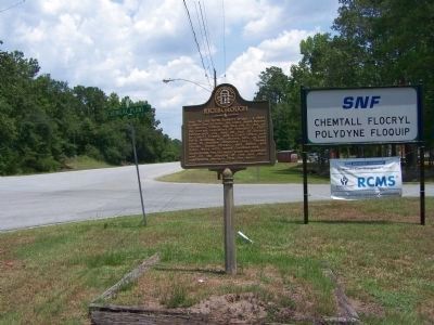
Photographed by Mike Stroud, 2008
2. Riceborough Marker, along US 17, looking northward
Credits. This page was last revised on October 21, 2020. It was originally submitted on July 12, 2008, by Mike Stroud of Bluffton, South Carolina. This page has been viewed 1,593 times since then and 38 times this year. Photos: 1, 2. submitted on July 12, 2008, by Mike Stroud of Bluffton, South Carolina. • Craig Swain was the editor who published this page.
