Highlands/Perkins in Baton Rouge in East Baton Rouge Parish, Louisiana — The American South (West South Central)
Louisiana State University and Agricultural and Mechanical College
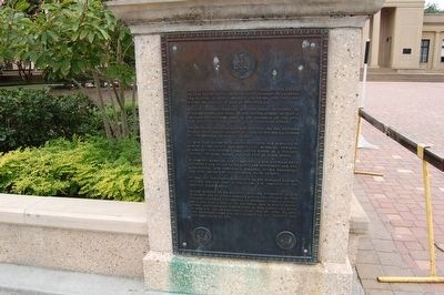
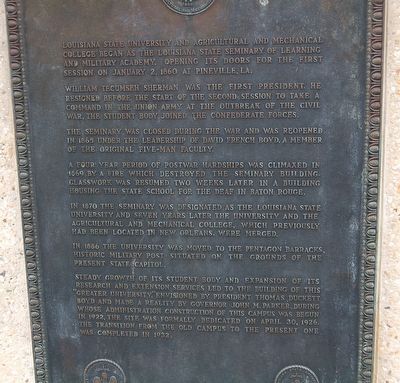
Inscription.
Louisiana State University and Agricultural and Mechanical College began as the Louisiana State Seminary of Learning and Military Academy, opening its door for the first session on January 2, 1860 at Pineville, LA.
William Tecumseh Sherman was the first President. He resigned before the start of the second session to take a command in the Union Army at the outbreak of the Civil War. The student body joined the Confederate forces.
The seminary was closed during the war and was reopened in 1865 under the leadership of David French Boyd, a member of the original five-man faculty.
A four year period of post war hardships was climaxed in 1869 by a fire which destroyed the seminary building. Classwork was resumed two weeks later in a building housing the State School for the Deaf in Baton Rouge.
In 1870 the seminary was designated as the Louisiana State University and seven years later the university and the Agricultural and the Mechanical College, which previously had been located in New Orleans, were merged.
In 1886 the University was moved to the Pentagon Barracks historic military post situated on the grounds of the present State Capitol.
Steady growth of its student body and extension services led to the building of this "Greater University", envisioned by the President Thomas Duckett Boyd and made a reality by Governor John M. Parker, during whose administration construction of this campus was begun in 1922. The site was formally dedicated on April 30. 1926. The transition from the old campus to the present one was completed in 1932.
Topics. This historical marker is listed in these topic lists: Education • War, US Civil. A significant historical date for this entry is January 2, 1860.
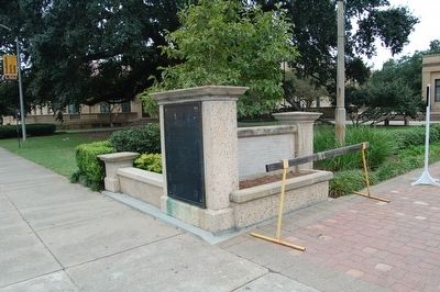
Location. 30° 24.865′ N, 91° 10.703′ W. Marker is in Baton Rouge, Louisiana, in East Baton Rouge Parish. It is in Highlands/Perkins. Marker is on Tower Drive, 0.1 miles south of Dalrymple Drive, on the right when traveling south. Touch for map. Marker is in this post office area: Baton Rouge LA 70803, United States of America. Touch for directions.
Other nearby markers. At least 8 other markers are within walking distance of this marker. Louisiana State Seminary of Learning Foundation Stone (a few steps from this marker); Land Grant College / Sea Grant College (a few steps from this marker); Parade Ground (within shouting distance of this marker); Campanile (within shouting distance of this marker); The Louisiana State University (within shouting distance of this marker); a different marker also named Parade Ground (about 600 feet away, measured in a direct line); a different marker also named Parade Ground (about 700 feet away); a different marker also named Parade Ground (about 700 feet away). Touch for a list and map of all markers in Baton Rouge.
Credits. This page was last revised on February 12, 2023. It was originally submitted on November 27, 2015. This page has been viewed 338 times since then and 11 times this year. Photos: 1, 2, 3. submitted on November 27, 2015. • Bernard Fisher was the editor who published this page.


