Maumee in Lucas County, Ohio — The American Midwest (Great Lakes)
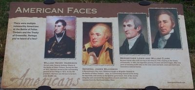
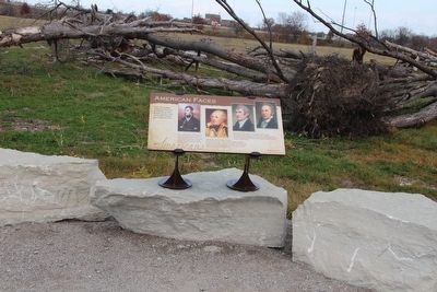
American Faces
Americans
William Henry Harrison
Served under General Anthony Wayne at the Battle of Fallen Timbers. During the War of 1812, Harrison served as the commanding general of Fort Meigs in 1813. As the 9th president, Harrison was the last to be born under British rule.
General James Wilkinson
A Revolutionary War hero, Wilkinson fought as Brigadier General at the Battle of Fallen Timbers. Later, as Commanding General of the Army, he reportedly sold secrets to the Spanish government. One of the secrets allegedly sold concerned the expedition of Lewis and Clark - two more veterans from the Northwest Indian Wars.
Meriwether Lewis and William Clark
Became friends after both serving in the Army in 1795, meeting at the Treaty of Greenville. In 1803, the legendary journey of Lewis and Clark began. After two years of traveling 8,000 miles to the west coast and back, Lewis and Clark were honored as national heroes.
Erected by Metroparks of the Toledo Area.
Topics and series. This historical marker is listed in these topic lists: Exploration • War of 1812 • Wars, US Indian. In addition, it is included in the Former U.S. Presidents: #09 William Henry Harrison, and the Lewis & Clark Expedition series lists. A significant historical year for this entry is 1812.
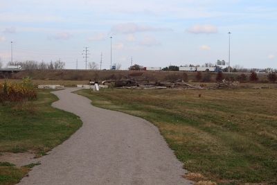
Location. 41° 33.254′ N, 83° 41.406′ W. Marker is in Maumee, Ohio, in Lucas County. Marker can be reached from North Jerome Road south of Monclova Road, on the left when traveling south. This marker is located on the grounds of the Fallen Timbers Battlefield, Metropark, in a clearing near the Interstate 475 and U.S. 24 exchange, and is the thirteenth in a series of markers seen along the Fallen Timbers Battlefield, walking trail. Touch for map. Marker is in this post office area: Maumee OH 43537, United States of America. Touch for directions.
Other nearby markers. At least 8 other markers are within walking distance of this marker. Treaty of Greenville (here, next to this marker); Aftermath of War (here, next to this marker); Alliances (approx. 0.2 miles away); Fort Miamis Connection (approx. 0.2 miles away); The Battle Ends (approx. ¼ mile away); Ready, Aim, Fire! (approx. ¼ mile away); The Battle Begins (approx. ¼ mile away); Archeology & Artifacts (approx. 0.4 miles away). Touch for a list and map of all markers in Maumee.
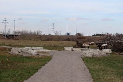
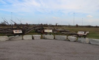
More about this marker. This particular marker is one of three markers located in an area that is part of the main park trail known as the "Downed Timber Node." The node area is surrounded by a number of large, rough cut, rectangular, stones, sitting in a clearing near the expressway interchange, with a number of well placed fallen timbers nearby.
Photographed By Dale K. Benington, November 5, 2015
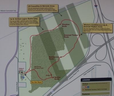
6. Map of the Fallen Timbers Metropark's Walking Trail
View of a map of the Fallen Timbers Battlefield park, showing the park's walking trail in red, and showing the "Downed Timber Node" (where this marker is located), near the right center of the map
Credits. This page was last revised on December 2, 2019. It was originally submitted on November 27, 2015, by Dale K. Benington of Toledo, Ohio. This page has been viewed 449 times since then and 15 times this year. Photos: 1, 2, 3, 4, 5, 6. submitted on March 17, 2016, by Dale K. Benington of Toledo, Ohio.
