Confederate States of America - Battle Flags
Confederate Battle Flag
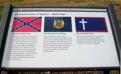
This battle flag, often called the Southern Cross flag, is the flag most often associated with the Confederate States of America (CSA) today. The Army of Northern Virginia first used the design as a square flag. Confederate troops carried many versions of the battle flag, including this version from the Army of Tennessee. On the battlefield, regimental or divisional battle flags served a variety of functions: they helped the men stay together during the confusion of battle; they acted as a rallying point for retreats or charges; and they allowed observers to follow the course of the battle.
Missouri State Guard Flag
After seceding from the Union, many states adopted state flags. Missouri did not create an official Confederate state flag, but Gen. Sterling Price did adopt a state guard flag for use by militia units in the spring of 1861. The Missouri State Guard did not transfer as a unit to the Confederate Army, but many ex-State Guard soldiers joined Missouri Confederate units.
Missouri Battle Flag
Many regiments, especially those serving in the west, developed their own regimental flags. Several Missouri Confederate regiments carried this flag, often called Price's flag. Today it is also referred to as the Missouri battle flag.
Erected by
Topics. This historical marker is listed in these topic lists: Communications • War, US Civil. A significant historical year for this entry is 1861.
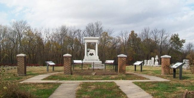
Location. 39° 5.913′ N, 93° 43.777′ W. Marker is in Higginsville, Missouri, in Lafayette County. Marker is on 1st Street, 0.4 miles north of Business Missouri Route 13, on the left when traveling north. Marker is just inside the cemetery entrance at the Confederate Memorial State Historic Site. Touch for map. Marker is in this post office area: Higginsville MO 64037, United States of America. Touch for directions.
Other nearby markers. At least 8 other markers are within walking distance of this marker. Our Confederate Dead (here, next to this marker); Confederate States of America - National Flags (a few steps from this marker); Confederate Memorial State Historic Site (a few steps from this marker); Lion of Lucerne (a few steps from this marker); Confederate Home Chapel Restoration (a few steps from this marker); Cottage Row [and] The Confederate Home Chapel (within shouting distance of this marker); The Confederate Home of Missouri (within shouting distance of this marker); Confederate Soldiers' Monument (approx. 0.3 miles away). Touch for a list and map of all markers in Higginsville.
Also see . . .
1. Confederate Memorial State Historic Site MO. Missouri State parks website entry (Submitted on November 28, 2015, by William Fischer, Jr. of Scranton, Pennsylvania.)
2. A Brief History of the Confederate Flags. Mississippi History Now website entry (Submitted on November 28, 2015, by William Fischer, Jr. of Scranton, Pennsylvania.)
3. Civil War Flags. HistoryNet website entry (Submitted on November 28, 2015, by William Fischer, Jr. of Scranton, Pennsylvania.)
Credits. This page was last revised on June 2, 2022. It was originally submitted on November 28, 2015, by William Fischer, Jr. of Scranton, Pennsylvania. This page has been viewed 673 times since then and 44 times this year. Photos: 1, 2. submitted on November 28, 2015, by William Fischer, Jr. of Scranton, Pennsylvania.

