Pensacola in Escambia County, Florida — The American South (South Atlantic)
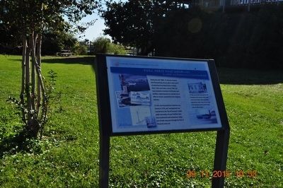
Piers, Ports and Wharves: A Look At Pensacola's Waterfront
Florida Public Archaeology Network
In 1943, the Pensacola Port Authority was formed; in 1976, port management was transferred to the City of Pensacola. Under public ownership, the port facilities have been modernized and maintained. Today, tons of bulk cargo pass through the Port of Pensacola each year.
Caption:
Pitt Slip is named after Pensacola’s B.R. Pitt & Company, which operated a planing mill at the corner of Main and Barracks Streets during the late 1800s. Today the site is home to Pitt Slip Marina and the Seville Harbour retail and office building.
Erected by University of West Florida.
Topics. This historical marker is listed in these topic lists: Industry & Commerce • Waterways & Vessels.
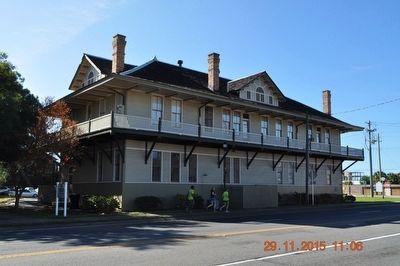
Location. 30° 24.446′ N, 87° 12.621′ W. Marker is in Pensacola, Florida, in Escambia County. Marker is at the intersection of South Barracks Street and East Main Street, on the left when traveling south on South Barracks Street. Marker is behind the Florida Public Archaeology Network building. Touch for map. Marker is at or near this postal address: 207 E Main St, Pensacola FL 32502, United States of America. Touch for directions.
Other nearby markers. At least 8 other markers are within walking distance of this marker. Pioneer Planing Mills (within shouting distance of this marker); Mooring Anchor (within shouting distance of this marker); Defending a Coastal Colony (within shouting distance of this marker); De Soto Trail / A Port with Promise (about 300 feet away, measured in a direct line); William Bartram Trail (about 400 feet away); Supremacy, Siege and the Sea (about 400 feet away); Tivoli High House (about 500 feet away); Old Christ Church (about 500 feet away). Touch for a list and map of all markers in Pensacola.
Also see . . . Florida Public Archaeology Network. (Submitted on December 1, 2015.)
Credits. This page was last revised on August 1, 2017. It was originally submitted on November 30, 2015, by Sandra Hughes Tidwell of Killen, Alabama, USA. This page has been viewed 791 times since then and 21 times this year. Photos: 1, 2, 3. submitted on November 30, 2015, by Sandra Hughes Tidwell of Killen, Alabama, USA. • Bernard Fisher was the editor who published this page.


