Guntown in Lee County, Mississippi — The American South (East South Central)
Tippah, Tishomingo, Pontotoc, Itawamba Intersection
Photographed by Brandon Fletcher, November 27, 2015
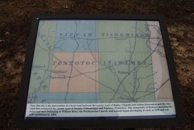
1. Tippah, Tishomingo, Pontotoc, Itawamba Intersection Marker
Near this site is the intersection of a local road between the county seats of Ripley (Tippah) and Fulton (Itawamba) and the wire road that connected the county seats of Jacinto (Tishomingo) and Pontotoc (Pontotoc). The community of Bethany, including the home and store belonging to William Brice; the Presbyterian Church; and schools began developing as early as 1845 and was well established by 1864.
Topics. This historical marker is listed in these topic lists: Roads & Vehicles • Settlements & Settlers. A significant historical year for this entry is 1845.
Location. 34° 30.463′ N, 88° 43.409′ W. Marker is in Guntown, Mississippi, in Lee County. It is on Bethany Road (State Highway 370) 0.4 miles east of County Route 833, on the right when traveling east. Touch for map. Marker is in this post office area: Guntown MS 38849, United States of America. Touch for directions.

Regionally, this marker is in andspecifically ast Mississippi in the North Mississippi Hills. It is also in the American South and specifically in the Deep South. Globally, it is in North America, a Gulf of Mexico state, the Western Hemisphere,
this page online
Other nearby markers. At least 8 other markers are within walking distance of this marker: Treaty of Pontotoc (here, next to this marker); Battle of Brice's Cross Roads, MS (here, next to this marker); Brice's Cross Roads (within shouting distance of this marker); Confederate's Second Battle Line (about 400 feet away, measured in a direct line); Federal Cavalry and Artillery Formed First Battle Line Here (about 500 feet away); a different marker also named Brice's Cross Roads (about 700 feet away); a different marker also named Brice's Cross Roads (approx. 0.2 miles away); Federal's Second Battle Line (approx. ¼ mile away). Touch for a list and map of all markers in Guntown.
Photographed by Brandon Fletcher, November 27, 2015
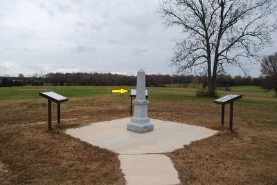
2. Tippah, Tishomingo, Pontotoc, Itawamba Intersection Marker
Photographed by Brandon Fletcher, November 27, 2015
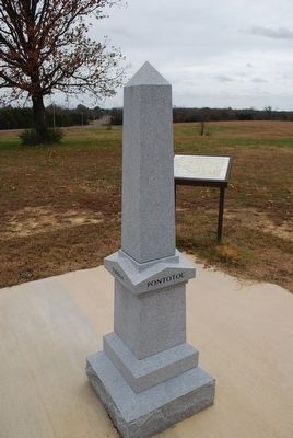
3. Tippah, Tishomingo, Pontotoc, Itawamba Intersection Marker
Photographed by Brandon Fletcher, November 27, 2015
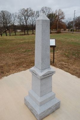
4. Tippah, Tishomingo, Pontotoc, Itawamba Intersection Marker
Credits. This page was last revised on June 16, 2016. It was originally submitted on December 2, 2015, by Brandon Fletcher of Chattanooga, Tennessee. This page has been viewed 557 times since then and 35 times this year. Photos: 1, 2, 3, 4. submitted on December 2, 2015, by Brandon Fletcher of Chattanooga, Tennessee. • Bernard Fisher was the editor who published this page.
