
Shiloh in Hardin County, Tennessee — The American South (East South Central)
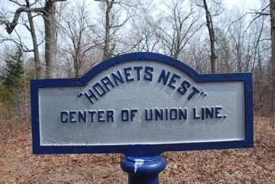
"Hornets Nest"
Photographed by Brandon Fletcher, March 19, 2011
1. "Hornets Nest" Marker
Topics. This historical marker is listed in this topic list: War, US Civil.
Location. 35° 8.145′ N, 88° 20.268′ W. Marker is in Shiloh, Tennessee, in Hardin County. It is on Eastern Corinth Road 0.3 miles south of Confederate Road. Touch for map. Marker is in this post office area: Shiloh TN 38376, United States of America. Touch for directions.

Regionally, this marker is in West Tennessee. It is also in the American South and specifically in the Upper South. Globally, it is in North America, the Western Hemisphere, the Western World, and the Anglosphere. Historically, it finds itself in what was once the territory of the Mississippian Culture, one of the Confederate States of America, and the Antebellum South.
Other nearby markers. At least 8 other markers are within walking distance of this marker: First Minnesota Light Artillery (a few steps from this marker); Surrender of the Hornets' Nest (within shouting distance of this marker); Impenetrable Thicket (within shouting distance of this marker); 14th Iowa Infantry Regiment (within
this page online
Also see . . . Shiloh National Military Park. National Park Service (Submitted on December 7, 2015.)
Photographed by Brandon Fletcher, November 28, 2015
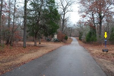
2. "Hornets Nest" Marker
Marker in distance to right (yellow arrow)
Credits. This page was last revised on June 16, 2016. It was originally submitted on December 5, 2015, by Brandon Fletcher of Chattanooga, Tennessee. This page has been viewed 1,123 times since then and 24 times this year. Photos: 1, 2. submitted on December 5, 2015, by Brandon Fletcher of Chattanooga, Tennessee. • Bernard Fisher was the editor who published this page.
