Near Parkman in Sheridan County, Wyoming — The American West (Mountains)
Pass, Wyoming
Stagecoach Roads in Sheridan County
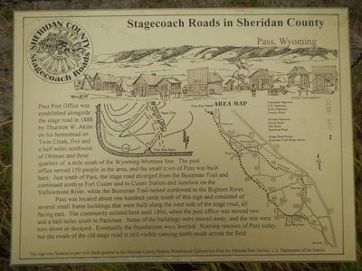
Photographed by Barry Swackhamer, September 16, 2015
1. Pass, Wyoming Marker
Pass was located about one hundred yards south of this sign and consisted of several small frame buildings that were built along the west side of the stage road, all facing east. The community existed here until 1894, when the post office was moved two and a half miles south to Parkman. Some of the buildings were moved away, and the rest were torn down or decayed. Eventually the foundations were leveled. Nothing remains of Pass today, but the swale of the old stage road is still visible running north-south across the field.
Erected by Sheridan County Historic Preservation Commission.
this page online
Topics and series. This historical marker is listed in this topic list: Roads & Vehicles. In addition, it is included in the Postal Mail and Philately series list.
Location. 44° 59.533′ N, 107° 20.968′ W. Marker is near Parkman, Wyoming, in Sheridan County. It is on Pass Creek Road (County Route 144) near Wyoming Highway 345, on the left. Touch for map. Marker is at or near this postal address: 92 Pass Creek Road, Parkman WY 82838, United States of America. Touch for directions.

Regionally, this marker is in the Powder River Basin. It is also in the American Mountain West. Globally, it is in North America, the Rocky Mountains, the Western Hemisphere, the Western World, and the Anglosphere.
Other nearby markers. At least 8 other markers are within 10 miles of this marker, measured as the crow flies: Bozeman Trail (approx. half a mile away); Ohlman Postoffice and Stage Station (approx. 4.7 miles away); Slack, Wyoming (approx. 5.3 miles away); Tongue River Crossing (approx. 8.8 miles away); Stagecoach Roads in Sheridan County (approx. 8.8 miles away); a different marker also
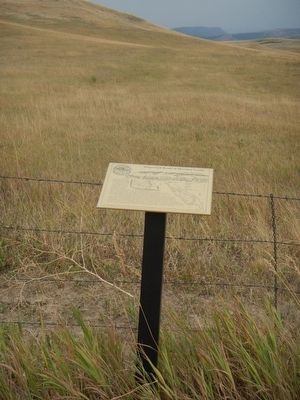
Photographed by Barry Swackhamer, September 16, 2015
2. Pass, Wyoming Marker
More about this marker. This marker is about one-half mile west of the intersection on Pass Creek Road and Wyoming Highway 345.
This plaque is one of six "Stagecoach Roads in Sheridan County" markers.
Credits. This page was last revised on June 16, 2016. It was originally submitted on December 10, 2015, by Barry Swackhamer of Brentwood, California. This page has been viewed 610 times since then and 31 times this year. Photos: 1, 2. submitted on December 10, 2015, by Barry Swackhamer of Brentwood, California.
