The Farmington Canal 1828-1848
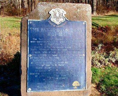
Present center developed around Bristol Basin. Whiting’s Basin lay west of Farmington Avenue with a dry dock halfway between.
Dug entirely by hand and horse. Canal was 36 feet wide, 4 feet deep, with 10-foot towpath.
Boats approximately 85 feet long pulled by horses or mules included the locally owned “Ceres” and “ H. M. Welch”; also the “James Hillhouse” and “Gold Hunter”.
Advent of railroads, geographical and financial problems contributed to early demise of waterway running from New Haven to Massachusetts
Erected 1971 by Connecticut Historic Commission and the Plainville Historical Society, Inc.
Topics. This historical marker is listed in this topic list: Waterways & Vessels. A significant historical year for this entry is 1828.
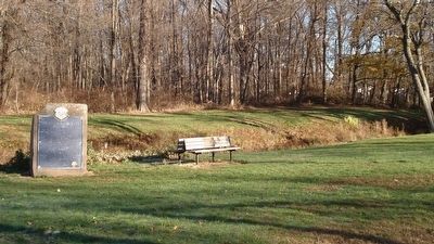
Location. 41° 39.683′ N, 72° 52.767′ W. Marker is in Plainville in Capitol Region, Connecticut. It is on Norton Park Road 0.2 miles west of Route 177, on the right when traveling west. Norton Park Road
this page online

Regionally, this marker is in the Connecticut River Valley, in Greater Hartford, and in the Knowledge Corridor. It is also in the American Northeast and in New England. Globally, it is in North America, the Western Hemisphere, the Western World, and the Anglosphere. Historically, it finds itself in what was once Hartford County and also one of the original Thirteen Colonies.
Other nearby markers. At least 8 other markers are within 3 miles of this marker, measured as the crow flies: Plainville World War I & II Monument (approx. 0.9 miles away); Plainville Civil War Memorial (approx. 0.9 miles away); Plainville Persian Gulf War Monument (approx. 0.9 miles away); Plainville Korean War – Vietnam War Monument (approx. 0.9 miles away); Olde East Street Burying Grounds (approx. one mile away); Come Ye To The Waters (approx. 2½ miles away); America's Oldest Amusement Park (approx. 2.7 miles away); 1985 Bicentennial Time Capsule (approx. 2.7 miles away). Touch for a list and map
Also see . . .
1. New England's Grand Ambition: The Farmington Canal. (Submitted on December 22, 2015, by Alan M. Perrie of Unionville, Connecticut.)
2. The Whitings basin and the Farmington Canal. (Submitted on December 29, 2015, by Alan M. Perrie of Unionville, Connecticut.)
Credits. This page was last revised on May 19, 2026. It was originally submitted on December 22, 2015, by Alan M. Perrie of Unionville, Connecticut. This page has been viewed 1,296 times since then and 93 times this year. Photos: 1, 2, 3, 4. submitted on December 22, 2015, by Alan M. Perrie of Unionville, Connecticut. • Bill Pfingsten was the editor who published this page.
