Tyler in Smith County, Texas — The American South (West South Central)
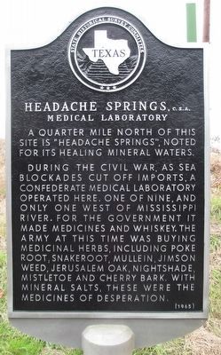
Headache Springs, C.S.A.
Medical Laboratory
Inscription.
A quarter mile north of this site is "Headache Springs," noted for its healing mineral waters.
During the Civil War, as sea blockades cut off imports, a Confederate medical laboratory operated here. One of nine, and only one west of Mississippi River. For the government it made medicines and whiskey. The army at this time was buying medicinal herbs, including poke root, snakeroot, mullein, jimson weed, Jerusalem oak, nightshade, mistletoe and cherry bark. With mineral salts, these were the medicines of desperation.
Erected 1965 by State Historical Survey Committee. (Marker Number 7732.)
Topics. This historical marker is listed in these topic lists: Science & Medicine • War, US Civil.
Location. 32° 19.98′ N, 95° 14.874′ W. Marker is in Tyler, Texas, in Smith County. Marker is at the intersection of East 5th Street (State Highway 64) and County Road 273, on the right when traveling west on East 5th Street. Touch for map. Marker is at or near this postal address: 9393 Highway 64 E, Tyler TX 75707, United States of America. Touch for directions.
Other nearby markers. At least 8 other markers are within 4 miles of this marker, measured as the crow flies. Tyler Junior College (approx. 2.1 miles away); Colonel Thomas R. Bonner / Texas In the Civil War 1861-1865 (approx. 2.7 miles away); Thomas Glover Pollard, Sr. (approx. 3 miles away); Rudolph Bergfeld (approx. 3.1 miles away); John B. & Ketura Douglas House (approx. 3.1 miles away); Woman's Building (approx. 3.1 miles away); The Connally Home (approx. 3.1 miles away); 1881 Smith County Jail (approx. 3.2 miles away). Touch for a list and map of all markers in Tyler.

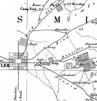
Photographed By Wilhelm Von Rosenberg, circa 1863
2. Headache Springs Medical Laboratory 1863 map
A segment of an 1863 military map of a "Reconnaissance of Sabine River and Vicinity - Plate 8" drawn by Captain Wilhem Von Rosenberg for the Confederate District of Texas, New Mexico and Arizona. The map shows the town of Tyler and on the road running to the lower right, Headache Springs shows as "CS Distillery." The map was drawn prior to the establishment of the Camp Ford POW Camp, as it only shows the Camp Ford Training Camp on the west side of the road leading northeast out of Tyler.
Credits. This page was last revised on June 16, 2016. It was originally submitted on December 29, 2015, by Randal B. Gilbert of Tyler, Texas. This page has been viewed 1,563 times since then and 162 times this year. Photos: 1, 2. submitted on December 29, 2015, by Randal B. Gilbert of Tyler, Texas. • Bernard Fisher was the editor who published this page.
Editor’s want-list for this marker. Wide shot of marker and its surroundings. • Can you help?
