Mesquite in Dallas County, Texas — The American South (West South Central)
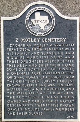
Z. Motley Cemetery
Erected 1976 by Texas Historical Commission. (Marker Number 6789.)
Topics. This historical marker is listed in these topic lists: Cemeteries & Burial Sites • Settlements & Settlers. A significant historical year for this entry is 1856.
Location. 32° 48.854′ N, 96° 39.451′ W. Marker is in Mesquite, Texas, in Dallas County. Marker is at the intersection of Motley Drive and Jan LeCroy Drive, on the right when traveling south on Motley Drive. Touch for map. Marker is at or near this postal address: 3737 Motley Drive, Mesquite TX 75150, United States of America. Touch for directions.
Other nearby markers. At least 8 other markers are within 4 miles of this marker, measured as the crow flies. La Prada Drive Church of Christ (approx. 1.9 miles away); Site of Galloway Farmstead (approx. 2 miles away); Buckner Log Cabin (approx. 2.3 miles away); Buckner Baptist Children's Home (approx. 2.3 miles away); Florence Ranch Home (approx. 2.4 miles away); Reinhardt Elementary School (approx. 2.6 miles away); Warren Angus Ferris Cemetery (approx. 3.1 miles away); Old Scyene Road (approx. 3˝ miles away). Touch for a list and map of all markers in Mesquite.
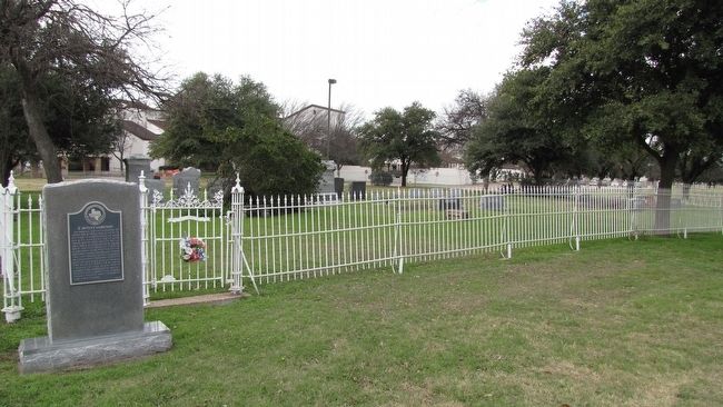
More about this marker. This cemetery and marker are on the Eastfield College campus. Eastfield College is part of the Dallas County Community College system.
Credits. This page was last revised on June 16, 2016. It was originally submitted on January 3, 2016, by QuesterMark of Fort Worth, Texas. This page has been viewed 486 times since then and 53 times this year. Photos: 1, 2. submitted on January 3, 2016, by QuesterMark of Fort Worth, Texas. • Bernard Fisher was the editor who published this page.

