Near Clear Lake in Deuel County, South Dakota — The American Midwest (Upper Plains)
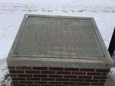
Hidewood Creek
Rest Area
This area contains many of the threads that were woven into the settlement of Dakota Territory. These rest areas are in Deuel County, which was created in 1862 by the first Territorial Legislature. In 1872 one of the first railroads penetrated into Dakota Territory at present-day Gary, 20 miles northeast of here, prior to settlement of much of this region. In pioneer days the status of a county seat was a clear distinction for a community, and many bitter wrangles preceded final selection. Clear Lake contested with Gary until 1890, when Clear Lake was finally successful in gaining the coveted status. For such winners, there were also losers; Castlewood, 12 miles west of here in Hamlin County, was the County seat from 1884 to 1914, when it lost that honor to Hayti. Religion was important to many settlers, as evidenced by the site of the Tabor Evangelical Church, about two miles northeast of here. The church was founded in 1888, and was in use until 1959. Many of the graves in the nearby cemetery are those of pioneers of this area.
There is no singular historic distinction to this particular rest area site, other than that it is a part of the stage for greater happenings, a witness to the tides of history.
Erected by State of South Dakota.
Topics. This historical marker is listed in these topic lists: Native Americans • Settlements & Settlers. A significant historical year for this entry is 1862.
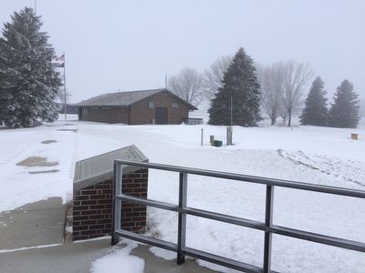
Location. 44° 41.898′ N, 96° 50.524′ W. Marker is near Clear Lake, South Dakota, in Deuel County. Marker can be reached from Interstate 29 at milepost 160,, 3 miles 188th St.. This rest area is only reachable going North on Interstate 29. At the rest area you can find the marker located at an overlook area a short walk behind the main building. Touch for map. Marker is in this post office area: Clear Lake SD 57226, United States of America. Touch for directions.
Other nearby markers. At least 6 other markers are within 14 miles of this marker, measured as the crow flies. Hidewood Creek Rest Area (approx. 0.3 miles away); Tabor Evangelical Church (approx. 3˝ miles away); Castlewood, South Dakota Veterans Memorial (approx. 9 miles away); District No. 5 Public School
(approx. 14 miles away); Holy Rosary Catholic Church (approx. 14 miles away); Holy Rosary Cemetery of Kranzburg / Holy Rosary Catholic Church (approx. 14 miles away).
Credits. This page was last revised on June 16, 2016. It was originally submitted on January 5, 2016, by Ruth VanSteenwyk of Aberdeen, South Dakota. This page has been viewed 535 times since then and 28 times this year. Photos: 1, 2, 3, 4. submitted on January 5, 2016, by Ruth VanSteenwyk of Aberdeen, South Dakota. • Bill Pfingsten was the editor who published this page.


