
Fort Eustis in Newport News, Virginia — The American South (Mid-Atlantic)
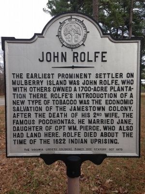
John Rolfe
Photographed by Kevin W., January 7, 2016
1. John Rolfe Marker
Erected 1975 by Virginia Society Colonial Dames XVII Century and the Corporation of Newport News, Virginia.
Topics and series. This historical marker is listed in these topic lists: Colonial Era • Settlements & Settlers. In addition, it is included in the The Colonial Dames XVII Century, National Society, and the Virginia, Corporation of Newport News series lists. A significant historical year for this entry is 1622.
Location. 37° 8.911′ N, 76° 36.141′ W. Marker is in Newport News, Virginia. It is in Fort Eustis. It is on Mulberry Island Road. Touch for map. Marker is in this post office area: Fort Eustis VA 23604, United States of America. Touch for directions.

Regionally, this marker is on Virginia’s Peninsula, in Hampton
this page online
Other nearby markers. At least 8 other markers are within walking distance of this marker: Native Americans on this Land (approx. half a mile away); The Civil War on Fort Eustis (approx. half a mile away); Felker Army Airfield (approx. half a mile away); Colossian Baptist Church (approx. half a mile away); The Landship (Building 415) (approx. 0.6 miles away); The Lee Hall Balloon School (approx. 0.7 miles away); Matthew Jones House (approx. 0.8 miles away); a different marker also named Matthew Jones House (approx. 0.8 miles away). Touch for a list and map of all markers in Newport News.
Photographed by Kevin W., January 7, 2016
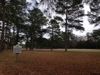
2. John Rolfe Marker
Credits. This page was last revised on February 1, 2023. It was originally submitted on January 7, 2016, by Kevin W. of Stafford, Virginia. This page has been viewed 1,521 times since then and 54 times this year. Photos: 1, 2. submitted on January 7, 2016, by Kevin W. of Stafford, Virginia.
