Akers in Tangipahoa Parish, Louisiana — The American South (West South Central)
Pass Manchac
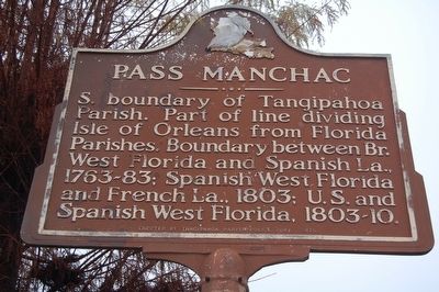
Photographed by Cajun Scrambler, January 7, 2016
1. Pass Manchac Marker
Erected 1975 by Tangipahoa Parish Police Jury.
Topics. This historical marker is listed in these topic lists: Colonial Era • Settlements & Settlers.
Location. 30° 17.427′ N, 90° 24.127′ W. Marker is in Akers, Louisiana, in Tangipahoa Parish. It is on Old U.S. 51 half a mile south of Mary Reno Lane, on the left when traveling south. Located at the Manchac/Akers exit 15 of Interstate 55. Touch for map. Marker is at or near this postal address: 30160 Old US-51, Akers LA 70421, United States of America. Touch for directions.

Regionally, this marker is in the Florida Parishes and in Greater New Orleans. It is also in the American South, specifically in the Deep South, and on the Gulf Coast. Globally, it is in North America, a Gulf of Mexico state, the Western Hemisphere, the Western World, and the Anglosphere. Historically,
this page online
Other nearby markers. At least 8 other markers are within 15 miles of this marker, measured as the crow flies: USS Ponchatoula Memorial (approx. 10½ miles away); Ponchatoula Depot (approx. 10½ miles away); PFC Raymond "Mike" Clausen, Jr. (approx. 10.7 miles away); Springfield (approx. 13 miles away); Springfield's Role in West Florida Revolution (approx. 13 miles away); Springfield Cemetery Cannon (approx. 13.2 miles away); Carter Plantation (approx. 13½ miles away); Haynes Settlement (approx. 14½ miles away).
Another marker is no longer nearby. 1862 Train Wreck (was approx. 9.2 miles away but has been confirmed missing).
Also see . . .
1. Links to Manchac Pass Lighthouse. Site has location pictures of the lighthouse about 0.7 miles east of Manchac Pass on Google maps with link to photo gallery. (Submitted on February 21, 2018, by Kenneth Ramagost of Louisiana, USA.)
2. Pass Manchac Light. Bottom of Site shows the Pass
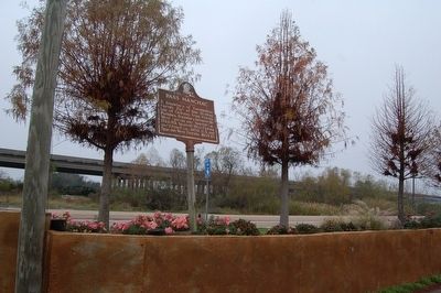
Photographed by Cajun Scrambler, January 7, 2016
2. Pass Manchac Marker
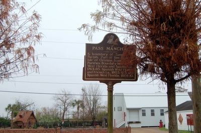
January 7, 2016
3. Pass Manchac Marker
Credits. This page was last revised on June 2, 2023. It was originally submitted on January 8, 2016. This page has been viewed 871 times since then and 53 times this year. Photos: 1, 2, 3. submitted on January 8, 2016. • Bernard Fisher was the editor who published this page.
