Near Chugwater in Platte County, Wyoming — The American West (Mountains)
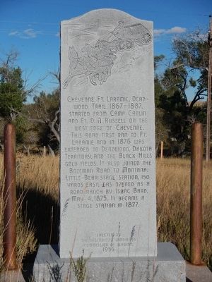
Little Bear Stage Station
This road first ran to Ft. Laramie and in 1876 was extended to Deadwood, Dakota Territory, and the Black Hills gold fields. It also joined the Bozeman Road to Montana.
Little Bear Stage Station, 150 yards east, was open as a road ranch by Isaac Bard, May 4, 1875. It became a stage station in 1877.
Erected 1956 by Historical Landmark Commission of Wyoming.
Topics. This historical marker is listed in this topic list: Roads & Vehicles.
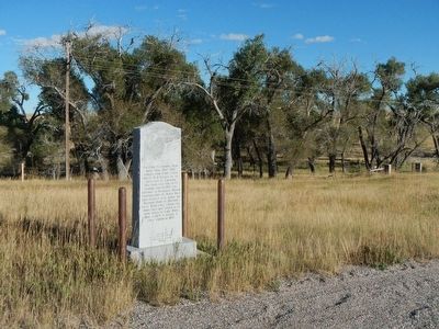
Location. 41° 29.886′ N, 104° 53.832′ W. Marker is near Chugwater, Wyoming, in Platte County. Marker is on I-25 Service Road (Old Highway 87) (at milepost 8.2) near Kimmo Road (County Route 120), on the right when traveling north. This marker is located on an service road on the east side of Interstate 25 about one mile north of exit 34 just north of the Little Bear Creek bridge. Touch for map. Marker is in this post office area: Chugwater WY 82210, United States of America. Touch for directions.
Other nearby markers. At least 1 other marker is within 11 miles of this marker, measured as the crow flies. Pole Creek Ranch (approx. 10.7 miles away).
Additional keywords. Cheyenne, Ft. Laramie, Deadwood Trail
Credits. This page was last revised on June 16, 2016. It was originally submitted on January 9, 2016, by Barry Swackhamer of Brentwood, California. This page has been viewed 992 times since then and 90 times this year. Photos: 1, 2. submitted on January 9, 2016, by Barry Swackhamer of Brentwood, California.

