Tyler in Smith County, Texas — The American South (West South Central)
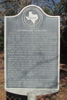
Shamburger Cemetery
Land surrounding this site was purchased by T.J. Shamburger and his wife, Settie, in 1874. The next year, this family graveyard was created upon the death of their two-month-old daughter, Nettie. In later years other Shamburger family members were interred here, including Mathew and Julia; T.J. and Settie; and a number of children, grandchildren, and in-laws. The last of T.J. and Settie's children to be buried in the family plot was a son, William Martin, in 1967.
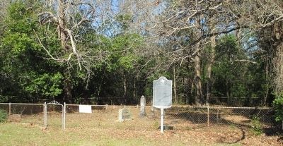
Among the graves here are three unmarked burials. The Shamburger Cemetery serves as a reminder of a pioneer East Texas family and their contributions to Smith County's agricultural development.
Erected 1990 by Texas Historical Commission. (Marker Number 7755.)
Topics. This historical marker is listed in these topic lists: Cemeteries & Burial Sites • Settlements & Settlers.
Location. 32° 25.602′ N, 95° 16.018′ W. Marker is in Tyler, Texas, in Smith County. Marker is on Pine Springs Road (County Route 334) 0.2 miles south of Fielder Road (County Route 330), on the right when traveling south. Touch for map. Marker is at or near this postal address: 5379 CR 334, Tyler TX 75708, United States of America. Touch for directions.
Other nearby markers. At least 8 other markers are within 3 miles of this marker, measured as the crow flies. Pine Springs Baptist Church (approx. 1.1 miles away); Camp Ford (approx. 2.1 miles away); a different marker also named Camp Ford (approx. 2.1 miles away); Camp Ford Stockade (approx. 2.1 miles away); Cabin of Lt. Col. J.B. Leake (approx. 2.1 miles away); Camp Ford Confederate Guards (approx. 2.1 miles away); Camp Ford - Establishment of the Camp (approx. 2.1 miles away); African Americans at Camp Ford (approx. 2.1 miles away). Touch for a list and map of all markers in Tyler.
Credits. This page was last revised on June 16, 2016. It was originally submitted on January 18, 2016, by Randal B. Gilbert of Tyler, Texas. This page has been viewed 385 times since then and 32 times this year. Photos: 1, 2. submitted on January 18, 2016, by Randal B. Gilbert of Tyler, Texas. • Bernard Fisher was the editor who published this page.

