Jonesboro in Coryell County, Texas — The American South (West South Central)
Wood Cemetery
Photographed by QuesterMark, July 2, 2014
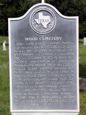
1. Wood Cemetery Texas Historical Marker
Erected 1994 by Texas Historical Commission. (Marker Number 5896.)
Topics. This historical marker is listed in this topic list: Cemeteries & Burial Sites. A significant historical year for this entry is 1858.
Location. 31° 34.946′ N, 97° 51.337′ W. Marker is in Jonesboro, Texas, in Coryell County. It is on County Road 194 0.9 miles south of 36th Division Memorial Highway (State Highway 36), on the right when traveling north. Touch for map. Marker is in this post office area: Jonesboro TX 76538, United States of America. Touch for directions.

Regionally, this marker
this page online
Other nearby markers. At least 8 other markers are within 12 miles of this marker, measured as the crow flies: Jonesboro Methodist Church (approx. 2½ miles away); Site of the Ireland School (approx. 6.7 miles away); Purmela Baptist Church (approx. 9.4 miles away); Smith Cemetery Memorial (approx. 11 miles away); John Raney Bertrand (approx. 11 miles away); Bethel Heights Baptist Church (approx. 11½ miles away); 1904 Leon River Bridge (approx. 11.7 miles away); Hemmeline Cemetery (approx. 11.8 miles away).
Photographed by QuesterMark, July 2, 2014
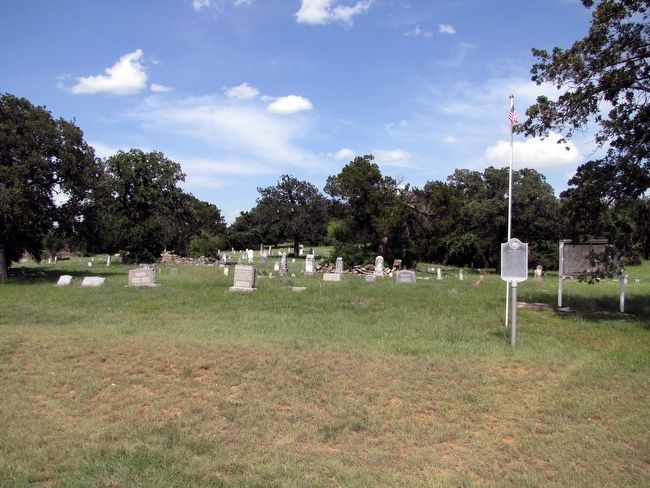
2. Wood Cemetery with Marker
Credits. This page was last revised on June 16, 2016. It was originally submitted on February 6, 2016, by QuesterMark of Fort Worth, Texas. This page has been viewed 2,984 times since then and 227 times this year. Photos: 1, 2. submitted on February 6, 2016, by QuesterMark of Fort Worth, Texas. • Bernard Fisher was the editor who published this page.
