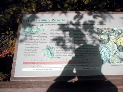
Fall in Muir Woods
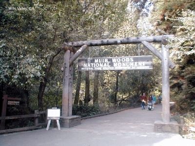
Muir Woods National Monument
Sonoma chipmunks busily prepare for hibernation. They forage through the woods in search of seeds, nuts, and berries. When their cheek pouches are full, they dig a small hole, empty the food into it, and then cover it with dirt and leaves.
Throughout the season, convergent ladybugs cluster on understory plants. They have flown here in early summer to escape inland heat.
They now gather in dense clusters near the creek, conserving body heat and emitting a foul smelling odor to ward off predators while they rest. In early spring they will wake up, mate, and return inland to lay their eggs.
Fall foliage floats to the canyon floor like rain drops. Poison oak’s “leaves of three” are flaming red, the maple leaves change from green to mustard, and the California bay-laurel leaves turn lemon yellow. These colorful leaves are not only a beautiful sight, they also provide nutrients for the forest and its animals. Big-leaf maples nourish black-tailed deer with calcium and potassium. Water striders feed on decomposing leaves in Redwood Creek. Migratory and resident birds fuel up on ripened poison oak, huckleberry fruits, tan oak acorns, and cow parsnip seeds.
October is the end of the dry season when fires are natural occurrence in the
forest. Fires release nutrients tied up in the soil, burn weak trees that compete for light in the forest canopy, clear piled up debris in the understory, and kill insects or disease that can potentially harm a forest. Bare mineral soil is necessary for redwood seeds to grow and allows the forest to regenerate with new growth. Sept-Ladybug cluster; Height of fall color; Warmest time of the year. Oct-Berries, buckeyes, and acorns ripen; Fire season. Nov-Migrating birds active; Rainy season begins.Erected by National Park Service, U.S. Department of the Interior.
Topics. This historical marker is listed in these topic lists: Environment • Horticulture & Forestry.
Location. 37° 53.567′ N, 122° 34.345′ W. Marker is in Mill Valley, California, in Marin County. Marker is on Muir Woods Road. The marker is near the Muir Woods National Monument visitor center. Touch for map. Marker is in this post office area: Mill Valley CA 94941, United States of America. Touch for directions.
Other nearby markers. At least 8 other markers are within 2 miles of this marker, measured as the crow flies. Preserving the Forest Primeval (here, next to this marker); Redwoods and Their Relatives (approx. ¼ mile away); United Nations Conference on International Organization (approx. 0.4 miles away); Reed's Mill (approx. 1.3 miles away); Old Mill Market Hikers' Trail Map (approx. 1.6 miles away); Mill Valley Railroad Depot (approx. 1.6 miles away); Outdoor Art Club (approx. 1.7 miles away); Grist Mill Stones (approx. 1.7 miles away). Touch for a list and map of all markers in Mill Valley.
Credits. This page was last revised on June 16, 2016. It was originally submitted on February 20, 2016, by Don Morfe of Baltimore, Maryland. This page has been viewed 441 times since then and 14 times this year. Photos: 1, 2, 3, 4, 5. submitted on February 20, 2016, by Don Morfe of Baltimore, Maryland. • Bill Pfingsten was the editor who published this page.
