Near Harman in Randolph County, West Virginia — The American South (Appalachia)
Pendleton County
⎯⎯⎯
Randolph County
Photographed by J. J. Prats, July 15, 2008
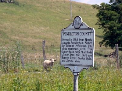
1. Pendleton County Face of Marker
Pendleton County. Formed in 1788 from Hardy, Augusta, Rockingham. Named for Edmund Pendleton, Virginia statesman-jurist. This county has a range of altitude of over 3500 feet. Here are Seneca Rocks, Smoke Hole, and Spruce Knob.
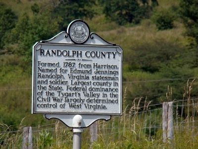
Randolph County. Formed, 1787, from Harrison. Named for Edmund Jennings Randolph, Virginia statesman and soldier. Largest county in the State. Federal dominance of the Tygart’s Valley in the Civil War largely determined control of West Virginia.
Erected 1964 by West Virginia Historic Commission.
Topics and series. This historical marker is listed in these topic lists: Settlements & Settlers • War, US Civil. In addition, it is included in the West Virginia Archives and History series list. A significant historical year for this entry is 1788.
Location. 38° 53.533′ N, 79° 28.074′ W. Marker is near Harman, West Virginia, in Randolph County. It is on U.S. 33, on the left when traveling east. Touch for map. Marker is in this post office area: Harman WV 26270, United States of America. Touch for directions.

Regionally, this marker is in West Virginia’s Potomac Highlands. It is also
this page online
Other nearby markers. At least 8 other markers are within 7 miles of this marker, measured as the crow flies: Veterans Memorial (approx. 3.6 miles away); Big Lime and Big Injun (approx. 3.9 miles away); Tory Camps / Seneca Trail (approx. 4.4 miles away); Tuscarora (Clinton) Sand (approx. 6.4 miles away); An 1800’s Garden! (approx. 6.4 miles away); A Melting Pot House (approx. 6.4 miles away); Sites Homestead (approx. 6.4 miles away); More Than One Way Up (approx. 6½ miles away). Touch for a list and map of all markers in Harman.
Another marker is no longer nearby. Seneca Rocks (was approx. 6.4 miles away but has been confirmed missing).
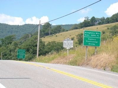
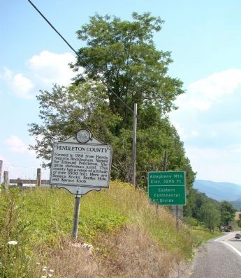
More about this marker. The county line here also marks the Eastern Continental Divide. Land to the west drains into the Gulf of Mexico. Land to the east drains into the Atlantic Ocean.
A note about nearby markers.
Photographed by J. J. Prats, July 15, 2008
2. Randolph County Face of Marker
Also see . . .
1. "A History of Pendleton County, West Virginia". Internet Archive website entry (Submitted on January 27, 2022, by Larry Gertner of New York, New York.)
2. Edmund Pendleton. Wikipedia entry (Submitted on January 27, 2022, by Larry Gertner of New York, New York.)
3. "A history of Randolph County, West Virginia, from its earliest exploration and settlement". Internet Archive website entry (Submitted on January 27, 2022, by Larry Gertner of New York, New York.)
4. Edmund Randolph. Wikipedia entry (Submitted on January 27, 2022, by Larry Gertner of New York, New York.)
Photographed by J. J. Prats, July 15, 2008
3. Marker at the Crest of the Road on Allegheny Mountain
This view is towards Randolph County.
Photographed by J. J. Prats, July 15, 2008
4. View Towards Pendleton County
Credits. This page was last revised on January 27, 2022. It was originally submitted on July 18, 2008, by J. J. Prats of Powell, Ohio. This page has been viewed 1,231 times since then and 27 times this year. Photos: 1, 2, 3, 4. submitted on July 18, 2008, by J. J. Prats of Powell, Ohio.
