Near Bend in Deschutes County, Oregon — The American West (Northwest)
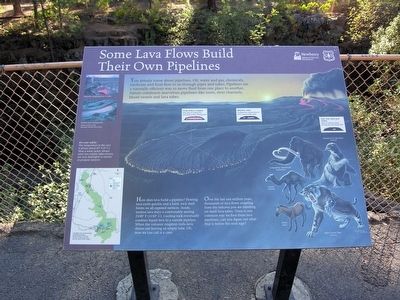
Some Lava Flows Build Their Own Pipelines
Newberry National Volcanic Monument
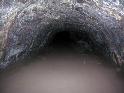
How does lava build a pipeline? Flowing lava cools quickly and a hard, rock shell forms on all exposed surfaces. Inside, molten lava stays a comfortably searing 2100° F (1150° C). Cooling rock eventually confines liquid lava to a narrow pipeline. When the volcanic eruption ends—lava drains out leaving an empty tube. OK, now we can call it a cave.
Over the last one million years, thousands of lava flows—erupting from the volcano you are standing on—built lava tubes. There is one common way we find these lava pipelines...can you figure out what that is before the next sign?
Erected by United States Forest Service.
Topics. This historical marker is listed in this topic list: Natural Features.
Location. 43° 53.704′ N, 121° 22.168′ W. Marker is near Bend, Oregon, in Deschutes County. Marker can be reached from Cottonwood Road, 0.7 miles north of Exit 151 (U.S. 97). Marker is located at the Lava River Cave Interpretive Site of Newberry National Volcanic Monument; it is near the entrance station. Touch for map. Marker is in this post office area: Bend OR 97707, United States of America. Touch for directions.
Other nearby markers. At least 8 other markers are within 11 miles of this marker, measured as the crow flies. Lava River Cave (a few steps from this marker); Lava Butte (approx. 1.7 miles away); River Ruler (approx. 3.3 miles away); Military Might Along The River: Camp Abbot (approx. 4.1 miles away); Journey of the Log to Lumber (approx. 10.7 miles away); Location, Location & Location (approx. 10.7 miles away); Today's Old Mill District (approx. 10.7 miles away); Thank Goodness for Water and Gravity (approx. 10.8 miles away). Touch for a list and map of all markers in Bend.
Also see . . . Lava River Cave - Wikipedia entry. (Submitted on March 8, 2016.)
Credits. This page was last revised on June 16, 2016. It was originally submitted on March 8, 2016, by Duane Hall of Abilene, Texas. This page has been viewed 290 times since then and 17 times this year. Photos: 1, 2. submitted on March 8, 2016, by Duane Hall of Abilene, Texas.

