St. Augustine in St. Johns County, Florida — The American South (South Atlantic)
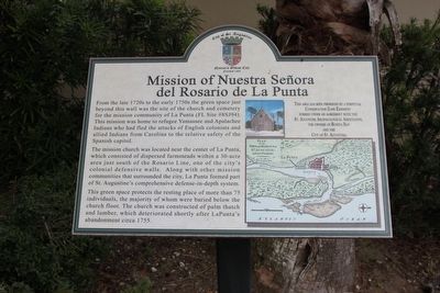
Mission of Nuestra Señora del Rosario de La Punta
Inscription.
From the late 1720s to the early 1750s the green space just beyond this wall was the site of the church and cemetery for the mission community of La Punta (FL Site #8SJ94). This mission was home to refugee Yamassee and Apalachee Indians who had fled the attacks of English colonists and allied Indians from Carolina to the relative safety of the Spanish capitol.
The mission church was located near the center of La Punta, which consisted of dispersed farmsteads within a 30-acre area just south of the Rosario Line, one of the city's colonial defensive walls. Along with other mission communities that surrounded the city, La Punta formed part of St. Augustine's comprehensive defense-in-depth system.
This green space protects the resting place of more than 75 individuals, the majority of whom were buried below the church floor. The church was constructed of palm thatch and lumber, which deteriorated shortly after La Punta's abandonment circa 1755.
This area has been preserved by a perpetual Conservation Zone Easement formed under an agreement with the St. Augustine Archaeological Association, the owners of Bonita Bay and the City of St. Augustine.
Erected by City of St. Augustine.
Topics. This historical marker is listed in these topic lists: Cemeteries & Burial Sites • Churches & Religion.
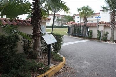
Location. 29° 53.008′ N, 81° 18.49′ W. Marker is in St. Augustine, Florida, in St. Johns County. Marker is at the intersection of Tremerton Street and South Street, on the right when traveling north on Tremerton Street. Touch for map. Marker is at or near this postal address: 11 Bonita Bay Dr, Saint Augustine FL 32084, United States of America. Touch for directions.
Other nearby markers. At least 8 other markers are within walking distance of this marker. The Powder House Lot / St. Johns County (about 700 feet away, measured in a direct line); Dade Pyramids (approx. 0.2 miles away); Address by President Lincoln (approx. 0.2 miles away); Never Forget Garden (approx. 0.2 miles away); A National Cemetery System (approx. 0.2 miles away); St. Augustine National Cemetery (approx. 0.2 miles away); Major Dade and His Command Monuments (approx. 0.2 miles away); King's Bakery (approx. ¼ mile away). Touch for a list and map of all markers in St. Augustine.
Credits. This page was last revised on January 2, 2019. It was originally submitted on March 12, 2016, by Tim Fillmon of Webster, Florida. This page has been viewed 432 times since then and 38 times this year. Photos: 1, 2. submitted on March 12, 2016, by Tim Fillmon of Webster, Florida. • Bernard Fisher was the editor who published this page.

