Near Sanford in Seminole County, Florida — The American South (South Atlantic)
George C. Means Memorial Bridge
Photographed by Tim Fillmon, December 24, 2015
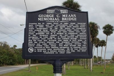
1. George C. Means Memorial Bridge Marker
Crossing the St. Johns River at Lake Jesup impacted both travelers and the environment over the years. Prior to 1900, people and goods were almost exclusively transported on the St. Johns by steamboat, with several large wharves around Lake Jesup being served. Competition from the new roads and railroads gradually led to a decline in steamboat traffic. In 1911, Congress passed an act that protected navigation on Lake Jesup. A ferry served the Geneva to Sanford road north of the current bridge. Around 1915 the road was bricked and made 8 feet wide. In 1920 the river's channel was dredged between Lake Harney and Lake Monroe, still passing around the oxbow within Lake Jesup. The first bridge was constructed in 1927, limiting navigation to passing under the turnstile drawbridge. SR 46 was widened in 1946 and a bypass channel was dug; the draw-
this page online
Erected by Seminole County Historical Commission.
Topics. This historical marker is listed in these topic lists: Bridges & Viaducts • Environment.
Location. 28° 47.221′ N, 81° 10.986′ W. Marker is near Sanford, Florida, in Seminole County. It is on Old Geneva Road north of State Road 46, on the right when traveling east. Marker is at the western approach to the bridge. Touch for map. Marker is in this post office area: Sanford FL 32771, United
Photographed by Tim Fillmon, December 24, 2015
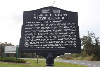
2. George C. Means Memorial Bridge Marker reverse

Regionally, this marker is in Greater Orlando and in Central Florida. It is also in the American South. Globally, it is in the North Atlantic Region, North America, a Gulf of Mexico state, the Western Hemisphere, the Western World, and the Anglosphere. Historically, it finds itself in what was once New Spain, the territory of the Mississippian Culture, one of the Confederate States of America, and the Antebellum South.
Other nearby markers. At least 8 other markers are within 4 miles of this marker, measured as the crow flies: Midway/Canaan City (approx. 2.9 miles away); Ramey Field (approx. 3.6 miles away); NAS Sanford/City of Sanford (approx. 3.6 miles away); RVAH 12 Speartips (approx. 3.6 miles away); The North American RA-5C Vigilante (approx. 3.6 miles away); U.S. Navy Enlisted Bombardier / Navigator (approx. 3.7 miles away); Naval Air Station - Sanford (approx. 3.7 miles away); Seminole County (approx. 3.8 miles away). Touch for a list and map of all markers in Sanford.
Photographed by Tim Fillmon, December 24, 2015
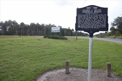
3. George C. Means Memorial Bridge Marker view looking west
Credits. This page was last revised on July 12, 2018. It was originally submitted on March 15, 2016, by Tim Fillmon of Webster, Florida. This page has been viewed 1,405 times since then and 111 times this year. Photos: 1, 2, 3. submitted on March 15, 2016, by Tim Fillmon of Webster, Florida. • Bernard Fisher was the editor who published this page.
