Canning Factory
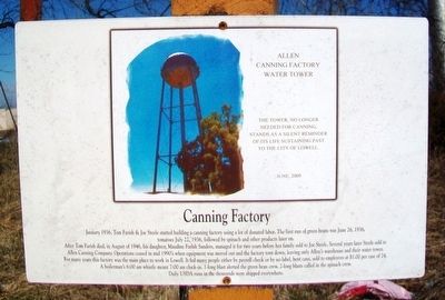
January 1936, Tom Farish & Joe Steele started building a canning factory using a lot of donated labor. The first run of green beans was June 26, 1936, tomatoes July 22, 1936, followed by spinach and other products later on.
After Tom Farish died, in August of 1946, his daughter, Maudine Farish Sanders, managed it for two years before her family sold to Joe Steele. Several years later Steele sold to Allen Canning Company. Operations ceased in mid 1990's when equipment was moved out and the factory torn down, leaving only Allen's warehouse and their water tower.
For many years this factory was the main place to work in Lowell. It fed many people either by payroll check or by no label, bent cans, sold to employees at $1.00 per case of 24. A boilerman's 6:00 am whistle meant 7:00 am clock-in. 1-long blast alerted the green bean crew. 2-long blasts called in the spinach crew. Daily USDA runs in the thousands were shipped everywhere.
[Inset photo caption reads]
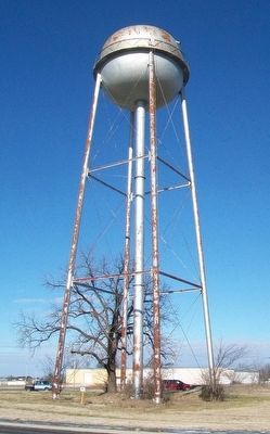
The tower, no longer needed for canning, stands as a silent reminder of its life sustaining past to the City of Lowell. June, 2009
Topics. This historical marker
this page online
Location. 36° 15.249′ N, 94° 7.89′ W. Marker is in Lowell, Arkansas, in Benton County. It is on Monroe Avenue east of Lincoln Street, on the left when traveling east. Touch for map. Marker is at or near this postal address: At the base of the water tower, Lowell AR 72745, United States of America. Touch for directions.

Regionally, this marker is in Northwest Arkansas, on the Ozark Plateau, in the Cherokee Heritage Region, and in Osage Territory. It is also in the American South, specifically in the Upper South, and in the Ozarks. Globally, it is in North America, the Western Hemisphere, the Western World, and the Anglosphere. Historically, it finds itself in what was once the territory of the Mississippian Culture, the Louisiana Purchase, one of the Confederate States of America, and the Antebellum South.
Other nearby markers. At least 8 other markers are within walking distance of this marker: First Free Will Baptist Church (approx. 0.2 miles away); L. P. Davis House and Grounds (approx. 0.2 miles
Another marker is no longer nearby. Old City Jail (was approx. 0.2 miles away but has been confirmed missing).
Credits. This page was last revised on August 16, 2020. It was originally submitted on March 25, 2016, by William Fischer, Jr. of Reynoldsburg, Ohio. This page has been viewed 1,091 times since then and 50 times this year. Photos: 1, 2. submitted on March 25, 2016, by William Fischer, Jr. of Reynoldsburg, Ohio.
