Throckmorton in Throckmorton County, Texas — The American South (West South Central)
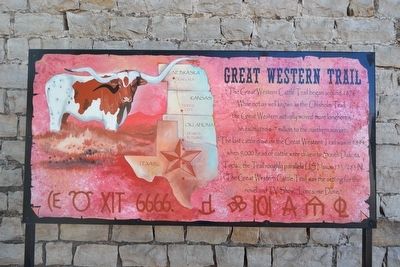
Great Western Trail
Topics. This historical marker is listed in these topic lists: Animals • Roads & Vehicles. A significant historical year for this entry is 1876.
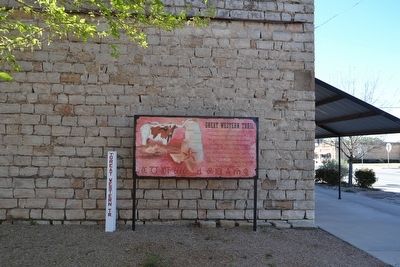
Location. 33° 10.736′ N, 99° 10.63′ W. Marker is in Throckmorton, Texas, in Throckmorton County. Marker can be reached from N. Minter Avenue (U.S. 283) north of E. Chesnut Street (U.S. 380), on the right when traveling north. Marker is located at the southwest corner of Pioneer Plaza. Touch for map. Marker is in this post office area: Throckmorton TX 76483, United States of America. Touch for directions.
Other nearby markers. At least 8 other markers are within 12 miles of this marker, measured as the crow flies. Throckmorton County Courthouse (within shouting distance of this marker); Throckmorton County Veterans Memorial (within shouting distance of this marker); Camp Cooper, C.S.A. (within shouting distance of this marker); Throckmorton County Jail (approx. 0.2 miles away); Throckmorton County (approx. one mile away); a different marker also named Great Western Trail (approx. 2.7 miles away); Bush Knob Massacre (approx. 6 miles away); Site of the Principal Village of the Comanche Indian Reserve (approx. 11˝ miles away). Touch for a list and map of all markers in Throckmorton.
Also see . . . Western Trail. From the Texas State Historical Association’s “Handbook of Texas Online”. (Submitted on March 27, 2016.)
Credits. This page was last revised on June 16, 2016. It was originally submitted on March 27, 2016, by Duane Hall of Abilene, Texas. This page has been viewed 433 times since then and 12 times this year. Photos: 1, 2, 3. submitted on March 27, 2016, by Duane Hall of Abilene, Texas.


