Near Spearman in Hansford County, Texas — The American South (West South Central)
Dodge City-Tascosa Trail
Photographed by Bill Kirchner, March 16, 2016
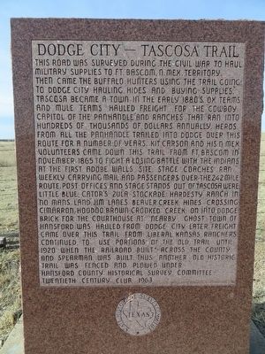
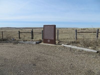
1. Dodge City-Tascosa Trail Marker
Inscription.
This road was surveyed during the Civil War to haul military supplies to Ft. Bascom, N. Mex. Territory. Then came the buffalo hunters using the trail going to Dodge City hauling hides and buying supplies. Tascosa became a town in the early 1880's. Ox teams and mule teams hauled freight for the cowboy capitol of the Panhandle and ranches that ran into hundreds of dollars annually. Herds from all the Panhandle trailed into Dodge over this route for a number of years. Kit Carson and his N. Mex. Volunteers came down this trail from Ft. Bascom in November 1865 to fight a losing battle with the Indians at the First Adobe Walls Site. Stage coaches ran weekly carrying mail and passengers over the 242 mile route. Post Offices and stage stands out of Tascosa were Little Blue, Cator's Zulu Stockade, Hardesty Ranch in "No Man's Land", Jim Lanes Beaver Creek, Hines Crossing, Cimarron, Hoodoo Brown, Crooked Creek, on into Dodge. Brick for the courthouse at nearby ghost town of Hansford was hauled from Dodge City. Later freight came over this trail from Liberal, Kansas. Ranchers continued to use portions of the old trail until 1920 when
Click or scan to see this page online
the railroad built across the county and Spearman was built. Thus another old historic trail was fenced and plowed under.
Erected 1963 by Hansford County Historical Survey Committee, Twentieth Century Club. (Marker Number 1238.)
Topics. This historical marker is listed in this topic list: Roads & Vehicles. A significant historical year for this entry is 1865.
Location. 36° 12.276′ N, 101° 18.615′ W. Marker is near Spearman, Texas, in Hansford County. It is on State Highway 15/207 0.7 miles east of Farm to Market Road 2018, on the right when traveling east. Touch for map. Marker is in this post office area: Spearman TX 79081, United States of America. Touch for directions.
Regionally, this marker is on the Texas Panhandle. It is also on the American Great Plains and specifically on the Southern Plains. Globally, it is in North America, a Gulf of Mexico state, the Western Hemisphere, the Western World, and the Anglosphere. Historically, it finds itself in what was once New Spain, the Comanchería, the Dust Bowl, the Republic of Texas, and one of the Confederate States of America.
Credits. This page was last revised on June 16, 2016. It was originally submitted on March 29, 2016, by Bill Kirchner of Tucson, Arizona. This page has been viewed 805 times since then and 41 times this year. Photos:1, 2. submitted on March 29, 2016, by Bill Kirchner of Tucson, Arizona.