Near Lipscomb in Lipscomb County, Texas — The American South (West South Central)
St. John's Lutheran Church Cemetery
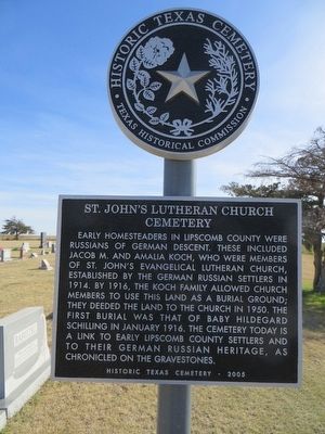
Photographed by Bill Kirchner, March 16, 2016
1. St. John's Lutheran Church Cemetery Marker
Erected 2005 by Texas Historical Commission. (Marker Number 14585.)
Topics. This historical marker is listed in this topic list: Cemeteries & Burial Sites. A significant historical month for this entry is January 1916.
Location. 36° 12.962′ N, 100° 16.009′ W. Marker is near Lipscomb, Texas, in Lipscomb County. It is at the intersection of County Road 17 and County Road V, on the right when traveling south on County Road 17. Touch for map. Marker is in this post office area: Lipscomb TX 79056, United States of America. Touch for directions.

Regionally,
this page online
Other nearby markers. At least 8 other markers are within 14 miles of this marker, measured as the crow flies: Lipscomb School (approx. 1.1 miles away); Lipscomb Union Church (approx. 1.2 miles away); Lipscomb Cemetery (approx. 1.2 miles away); Lipscomb County Courthouse (approx. 1.3 miles away); Lipscomb, Texas (approx. 1.3 miles away); Quanah Parker Trail (approx. 1.3 miles away); Fairview Cemetery (approx. 11.4 miles away); Glazier Cemetery (approx. 13.6 miles away). Touch for a list and map of all markers in Lipscomb.
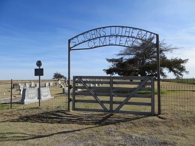
Photographed by Bill Kirchner, March 16, 2016
2. St. John's Lutheran Church Cemetery Marker
Credits. This page was last revised on June 16, 2016. It was originally submitted on April 4, 2016, by Bill Kirchner of Tucson, Arizona. This page has been viewed 530 times since then and 23 times this year. Photos: 1, 2. submitted on April 4, 2016, by Bill Kirchner of Tucson, Arizona.
