North Druid Hills in Decatur in DeKalb County, Georgia — The American South (South Atlantic)
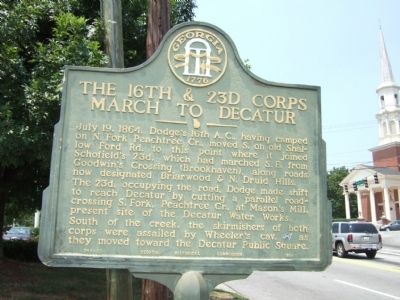
The 16th & 23d Corps March to Decatur
July 19, 1864. Dodge's 16th A.C., having camped on N. Fork Peachtree Cr., moved S. on old Shallowford Rd. to this point where it joined Schofield's 23d, which had marched S.E. from Goodwin's Crossing (Brookhaven), along roads now designated Briarwood & N. Druid Hills. The 23d, occupying the road, Dodge made shift to reach Decatur by cutting a parallel road-crossing S. Fork, Peachtree Cr., at Mason's Mill, present site of the Decatur Water Works.
South of the creek, the skirmishers of both corps were assailed by Wheeler's cav. (CS) as they moved toward the Decatur Public Square.
Erected 1954 by Georgia HIstorical Commission. (Marker Number 044-23.)
Topics and series. This historical marker is listed in this topic list: War, US Civil. In addition, it is included in the Georgia Historical Society series list. A significant historical date for this entry is July 19, 1772.
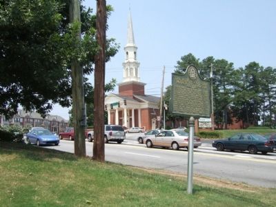
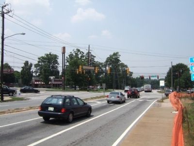
Location. Marker has been reported missing. It was located near 33° 48.709′ N, 84° 18.437′ W. Marker was in Decatur, Georgia, in DeKalb County. It was in North Druid Hills. Marker was at the intersection of North Druid Hills Road (Georgia Route 42) and Clairmont Road (Georgia Route 155), on the left when traveling east on North Druid Hills Road. Touch for map. Marker was in this post office area: Decatur GA 30030, United States of America. Touch for directions.
Other nearby markers. At least 8 other markers are within 2 miles of this location, measured as the crow flies. Site: J. Oliver Powell House Sherman's H'dq'rs (approx. 1.1 miles away); The Hardman Family Cemetery (approx. 1.2 miles away); Trail to Standing Peachtree and Houston Chapel (approx. 1½ miles away); Dr. Chapmon Powell’s “Medicine House” and W.J. Houston Plantation (approx. 1½ miles away); Stanley & Wood March To Durand's Mill (approx. 1.6 miles away); Durand's Mill (approx. 1.7 miles away); Site: Judge James Paden House: Gen. J.D. Cox’s H’dq’rs (approx. 1.7 miles away); 4th A.C. at Durand's Mill (approx. 1.9 miles away). Touch for a list and map of all markers in Decatur.
Credits. This page was last revised on February 8, 2023. It was originally submitted on July 20, 2008, by Felch Dumas of Decatur, Georgia. This page has been viewed 1,154 times since then and 9 times this year. Photos: 1, 2, 3. submitted on July 20, 2008, by Felch Dumas of Decatur, Georgia. • Craig Swain was the editor who published this page.


