Near Albany in Shackelford County, Texas — The American South (West South Central)
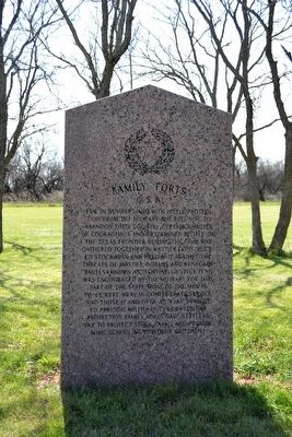
Family Forts, C.S.A.
(Front Side)
Few in numbers and with little protection from the military but refusing to abandon their country, certain families of courageous and determined people on the Texas frontier during the Civil War gathered together in hastily constructed stockades and held out against the threats of hostile Indians and renegade whites ▲ Known as “forting up”, this plan was encouraged by the military for this part of the State. Most of the men 18 to 45 were away in Confederate service and those 17 and over 45 were subject to periodic militia duty for frontier protection. Family forts gave settlers way to protect stock, farms and provide some schooling for their children ▲
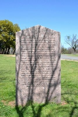
(Rear Side)
Best-known family fort in this sector was Fort Davis, located 8 miles east on bank Clear Fork of Brazos in Stephens County, where some 120 people lived during last year of Civil War. Named for Confederate President Jefferson Davis, it was laid off in lots. Log houses with dirt roofs, mud in cracks, dirt floors, were connected by pickets driven into ground. A blockhouse was used by women and children during raids. There were no luxuries, little food, all clothes, soap, soda, candles were made. Nearest supplies were 100 miles away, doctor 65 miles. Yet, there were dances, candy pulls, weddings, “feasts”, Sunday school, occasional sermons and blue-backed spellers ▲ Other family forts near were Lynch and Green ranches, Shackelford County; Blair’s Fort, Allen’s Ranch, Eastland County; Buffalo Springs, Clay County; Picketville, Mugginsville, Owl’s Head, Stephens County.
Erected 1964 by State of Texas. (Marker Number 1565.)
Topics. This historical marker is listed in these topic lists: Forts and Castles • Settlements & Settlers • War, US Civil. A significant historical year for this entry is 1864.
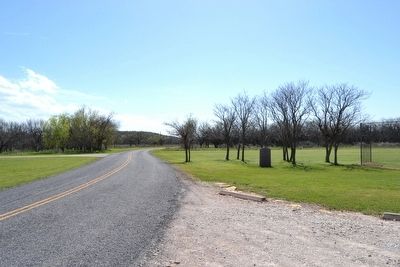
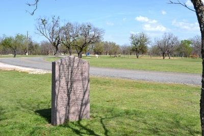
Location. 32° 55.54′ N, 99° 13.112′ W. Marker is near Albany, Texas, in Shackelford County. Marker is on Park Road 54, half a mile east of U.S. 283, on the left when traveling east. Marker is located in the east section of Fort Griffin State Historic Site on the north side of the campground. Touch for map. Marker is in this post office area: Albany TX 76430, United States of America. Touch for directions.
Other nearby markers. At least 8 other markers are within 2 miles of this marker, measured as the crow flies. Russell Young Gilbert (approx. 0.4 miles away); Fort Griffin Civil Jail (approx. 0.8 miles away); The Western Cattle Trail Crossings at Fort Griffin (approx. 0.8 miles away); Frontier Town of Fort Griffin (approx. 0.8 miles away); Civilian Conservation Corps at Fort Griffin (approx. 0.9 miles away); Fort Griffin (approx. 0.9 miles away); Fort Griffin Lodge Hall (approx. 0.9 miles away); Black Cemetery (approx. 1.7 miles away). Touch for a list and map of all markers in Albany.
Also see . . . Fort Davis. From the Texas State Historical Association’s “Handbook of Texas Online”. (Submitted on April 5, 2016.)
Credits. This page was last revised on June 16, 2016. It was originally submitted on April 5, 2016, by Duane Hall of Abilene, Texas. This page has been viewed 521 times since then and 20 times this year. Photos: 1, 2, 3, 4. submitted on April 5, 2016, by Duane Hall of Abilene, Texas.


