
Gainesville in Alachua County, Florida — The American South (South Atlantic)
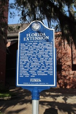
Florida Extension
Photographed by Tim Fillmon, April 9, 2016
1. Florida Extension Marker
Erected 2015 by The UF Alumni Association.
Topics. This historical marker is listed in these topic lists: Agriculture • Education. A significant historical year for this entry is 1914.
Location. 29° 38.936′ N, 82° 20.679′ W. Marker is in Gainesville, Florida, in Alachua County. It is on Buckman Drive just north of Stadium Road, on the right when traveling north. Located in front of Rolfs Hall. Touch for map. Marker is in this post office area: Gainesville FL 32603, United States of America. Touch for directions.

Regionally, this marker is in North Florida. It is also in the American South. Globally, it is in the North Atlantic Region, North America, a Gulf of Mexico state, the Western Hemisphere, the Western World, and the Anglosphere. Historically, it finds itself in what was once New Spain, the territory of the Mississippian Culture, one of the Confederate States of America, and the Antebellum South.
Other nearby markers. At least 8 other markers are within walking distance
this page online
More about this marker. Marker is part of the University of Florida marker series.
Photographed by Tim Fillmon, April 9, 2016
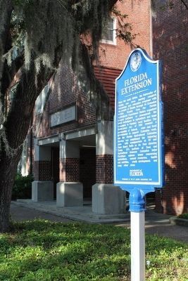
2. Florida Extension Marker with Rolfs Hall behind
Credits. This page was last revised on June 16, 2016. It was originally submitted on April 12, 2016, by Tim Fillmon of Webster, Florida. This page has been viewed 551 times since then and 36 times this year. Photos: 1, 2. submitted on April 12, 2016, by Tim Fillmon of Webster, Florida. • Bernard Fisher was the editor who published this page.
